|
search place name
|
||
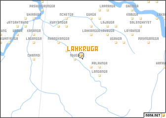
Lahkru Ga (Kachin State, Myanmar)Lahkru Ga is a town in the Kachin State region of Myanmar. An overview map of the region around Lahkru Ga is displayed below.
regional and 3d topo map of Lahkru Ga, Myanmar ::
Lahkru Ga airports ::
The nearest airport is MYT - Myitkyina, located 106.0 km south east of Lahkru Ga.
Other airports nearby include PBU - Putao (139.8 km north east), MOH - Mohanbari Dibrugarh (227.2 km north west), Nearby towns ::
'Ndu Ga (1.7km west) //
Laga Ga (2.5km south east) //
Shingboi Ga (3.8km north west) //
Palawn Ga (3.8km south east) //
La-ngan Ga (5.0km south east) //
Lahkang Ga (5.8km north) //
'Nwangkang Ga (6.2km north west) //
Htingnu Gahtawng (7.6km north) //
Kawbu Ga (7.5km north east) //
Sabaw Ga (8.1km north west) //
Ugaw Ga (7.6km north east) //
Lajau Ga (8.9km north east) //
Kumyang Ga (8.9km north west) //
Galun Ga (10.0km north east) //
[all distances 'as the bird flies' and approximate] 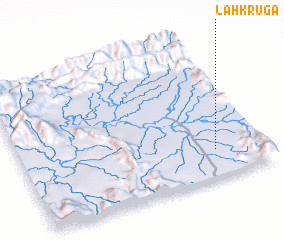 Places with similar names to Lahkru Ga, Myanmar ::
// Locaroc (PH)
// Lee Creek (US)
// La Correggia (IT)
// Lagariça (PT)
// La Carraca (ES)
// Likurga (RU)
// Lucarque (EC)
// Lekuruki (TZ)
// Luguruka (TZ)
// Lakar Kūh (IR)
Disclaimer :: Information on this page comes without warranty of any kind |
||
|
Where is Lahkru Ga? Elevation and coordinates ::
Latitude (lat): 26°12'0"N Longitude (lon): 96°48'0"E
Elevation (approx.): 224m (map arrows pan, magnifying glasses zoom) |
||
|
Visiting Lahkru Ga? Hotel/Accommodation ::
Book a hotel in Lahkru Ga Travel Guide ::
Buy a travel guide for Myanmar rental cars ::
car rental offers GPS waypoint ::
download a GPX waypoint (PoI) of Lahkru Ga for your GPS receiver
|
||