|
search place name
|
||
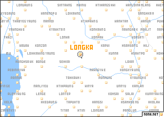
Longka (Shan, Myanmar)Longka is a town in the Shan region of Myanmar. An overview map of the region around Longka is displayed below.
regional and 3d topo map of Longka, Myanmar ::
Longka airports ::
The nearest airport is HEH - Heho, located 32.9 km north west of Longka.
Other airports nearby include MDL - Mandalay Intl (166.4 km north west), Nearby towns ::
Nawngpit (1.9km south) //
Kyawktengze (3.7km north) //
Kyawk Teng (4.1km north west) //
Chu-eng (3.9km north west) //
Se-hkai (3.9km south west) //
Ka Hsan Keng (5.1km north east) //
Konpaw (5.1km north east) //
Kanpaw Tang-tok (5.1km north east) //
Nawng-ywe (5.1km south east) //
Lonwa (5.1km north west) //
Ponchitpeng (5.6km south) //
Ka-pwi (5.5km east) //
Ta Hkaw Mi (5.8km south) //
Kon-kawng (6.6km north east) //
Möng Lun (6.9km east) //
Kun-Na (6.9km east) //
Nahi (7.4km south) //
Hti-hpawng (7.6km north) //
Win-ya (7.6km south) //
Kyawktan (7.6km north west) //
Pon Peng (7.6km south east) //
Hti-hpaung (8.2km south west) //
Mote-ein (8.9km north east) //
Namnoi (10.2km north west) //
[all distances 'as the bird flies' and approximate]  Places with similar names to Longka, Myanmar ::
Disclaimer :: Information on this page comes without warranty of any kind |
||
|
Where is Longka? Elevation and coordinates ::
Latitude (lat): 20°36'0"N Longitude (lon): 97°4'0"E
Elevation (approx.): 1340m (map arrows pan, magnifying glasses zoom) |
||
|
Visiting Longka? Hotel/Accommodation ::
Book a hotel in Longka Travel Guide ::
Buy a travel guide for Myanmar rental cars ::
car rental offers GPS waypoint ::
download a GPX waypoint (PoI) of Longka for your GPS receiver
|
||