|
search place name
|
||
Madetaung (Rakhine, Myanmar)Madetaung is a town in the Rakhine region of Myanmar. An overview map of the region around Madetaung is displayed below.
regional and 3d topo map of Madetaung, Myanmar ::

Madetaung airports ::
The nearest airport is KYP - Kyaukpyu, located 40.0 km south west of Madetaung.
Other airports nearby include AKY - Sittwe (106.7 km north west), SNW - Thandwe (147.6 km south), CXB - Cox's Bazar Coxs Bazar (271.3 km north west), Nearby towns ::
Pyinshebyin (1.9km north) //
Gaungpyudaung (2.5km south west) //
Warachaung (2.5km north west) //
Kyaukhpya (3.5km west) //
Kyachit (4.1km south east) //
Yegaungchwein (5.1km north west) //
Chindaung (5.1km north west) //
Kyaukchaung (5.6km north) //
Taungshe (5.6km south) //
Ngazane (5.6km east) //
Mawhun (7.0km east) //
Ru-ywa (7.6km north east) //
Pauktudaung (9.1km north west) //
Dattaung (9.1km north west) //
[all distances 'as the bird flies' and approximate] 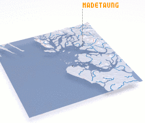 Places with similar names to Madetaung, Myanmar ::
// Modutung (ZA)
// Matatengo (MX)
// Moudou Tounga (NE)
// Mtatanga (TZ)
// Madae-dong (KP)
// Mado-dong (KR)
// Mut'ae-dong (KR)
// Maidād Nīka (PK)
// Mutoudeng (CN)
// Mutoutang (CN)
Disclaimer :: Information on this page comes without warranty of any kind |
||
|
Where is Madetaung? Elevation and coordinates ::
Latitude (lat): 19°42'0"N Longitude (lon): 93°47'0"E
Elevation (approx.): -1m (map arrows pan, magnifying glasses zoom) |
||
|
Visiting Madetaung? Hotel/Accommodation ::
Book a hotel in Madetaung Travel Guide ::
Buy a travel guide for Myanmar rental cars ::
car rental offers GPS waypoint ::
download a GPX waypoint (PoI) of Madetaung for your GPS receiver
|
||