|
search place name
|
||
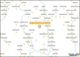
Makmöngkong (Shan, Myanmar)Makmöngkong is a town in the Shan region of Myanmar. An overview map of the region around Makmöngkong is displayed below.
regional and 3d topo map of Makmöngkong, Myanmar ::
Makmöngkong airports ::
The nearest airport is LSH - Lashio, located 125.5 km north of Makmöngkong.
Other airports nearby include HEH - Heho (150.1 km south west), MDL - Mandalay Intl (172.0 km west), MOG - Mong Hsat (224.1 km south east), Nearby towns ::
Kun-hsan (1.9km north) //
Wān-pēk (2.5km south east) //
Mi-lön (2.5km south east) //
Hpa-lan (3.4km east) //
Loi-hsang (4.1km north west) //
Kyawng-pong (4.1km north east) //
Nawngmun (4.1km south east) //
Loi-ngon (3.9km south west) //
Wān Kun (3.9km north east) //
Wān Long (3.9km north east) //
Na-hpawk (3.9km south east) //
Hai-kun (5.1km north east) //
Hamngai (5.1km north east) //
Wān-kawng-mu (5.1km south east) //
Mān Htawk (5.6km north) //
Hki-hkaw (5.8km south) //
Wan-kawk (5.5km east) //
Ho-hpoi (5.8km north) //
Mākhkinu (6.4km north east) //
Nā-pong (6.4km south west) //
Hko-mit (6.4km south east) //
Konglang (6.9km west) //
Konglang (7.1km west) //
Pangsamhkam (7.1km west) //
Pāngkyehtu (7.1km west) //
Wan Tawng (7.6km north) //
Pāngngu (7.6km south) //
Loi-hsa (7.6km north west) //
Pāng-kat (7.6km north east) //
[all distances 'as the bird flies' and approximate]  Places with similar names to Makmöngkong, Myanmar :: Disclaimer :: Information on this page comes without warranty of any kind |
||
|
Where is Makmöngkong? Elevation and coordinates ::
Latitude (lat): 21°51'0"N Longitude (lon): 97°38'0"E
Elevation (approx.): 1113m (map arrows pan, magnifying glasses zoom) |
||
|
Visiting Makmöngkong? Hotel/Accommodation ::
Book a hotel in Makmöngkong Travel Guide ::
Buy a travel guide for Myanmar rental cars ::
car rental offers GPS waypoint ::
download a GPX waypoint (PoI) of Makmöngkong for your GPS receiver
|
||