|
search place name
|
||
Mān-ai (Shan, Myanmar)Mān-ai is a town in the Shan region of Myanmar. An overview map of the region around Mān-ai is displayed below.
regional and 3d topo map of Mān-ai, Myanmar ::

Mān-ai airports ::
The nearest airport is LSH - Lashio, located 6.8 km north of Mān-ai.
Other airports nearby include MDL - Mandalay Intl (226.8 km south west), KET - Kengtung (264.3 km south east), Nearby towns ::
Lashio (1.9km north) //
Kon-mon (1.7km west) //
Namkhai (3.9km south west) //
Hwei-yok (3.9km south east) //
Hkai-heo (4.1km north west) //
Mān-su (4.1km north east) //
Nam-sam (4.1km south west) //
Hu-mon (5.0km north east) //
Nam-now (5.0km south west) //
Nam-htam (5.0km south west) //
Hatka (5.8km north) //
Nampa Chi (5.8km north) //
Old Lashio (5.8km north) //
Lük-le (6.5km south west) //
Hko-lawng (6.5km north east) //
Hkonim (6.5km north west) //
Pangyao (6.3km south west) //
Mè-han (6.3km south west) //
Hke-hkam (7.4km north) //
Kon-son (6.8km west) //
I-nai (7.1km west) //
Nawa (7.6km north east) //
Nam-ngawn (7.8km north east) //
Loi-lawm (8.8km south west) //
Nawng-pat (8.8km south east) //
Nā-kawn-kong-nyaung (10.1km north west) //
[all distances 'as the bird flies' and approximate] 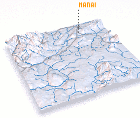 Places with similar names to Mān-ai, Myanmar ::
Disclaimer :: Information on this page comes without warranty of any kind |
||
|
Where is Mān-ai? Elevation and coordinates ::
Latitude (lat): 22°55'0"N Longitude (lon): 97°45'0"E
Elevation (approx.): 945m (map arrows pan, magnifying glasses zoom) |
||
|
Visiting Mān-ai? Hotel/Accommodation ::
Book a hotel in Mān-ai Travel Guide ::
Buy a travel guide for Myanmar rental cars ::
car rental offers GPS waypoint ::
download a GPX waypoint (PoI) of Mān-ai for your GPS receiver
|
||