|
search place name
|
||
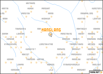
Mānglang (Shan, Myanmar)Mānglang is a town in the Shan region of Myanmar. An overview map of the region around Mānglang is displayed below.
regional and 3d topo map of Mānglang, Myanmar ::
Mānglang airports ::
The nearest airport is LSH - Lashio, located 46.4 km east of Mānglang.
Other airports nearby include MDL - Mandalay Intl (195.3 km south west), Nearby towns ::
Namlin (3.9km north west) //
Longtawktaö (4.1km south west) //
Longtawknö (4.1km south west) //
Pāngtawng (5.1km east) //
Hko-hkun (5.8km north) //
Mān Ngai (5.4km east) //
Mān Wing (6.5km south east) //
Mān-oi (7.4km north) //
Mānloinö (7.1km west) //
Mān Ping (7.6km south) //
Kunlong (8.2km south east) //
Ngaitaö (7.8km south east) //
Kunhkyet (8.8km south west) //
Tāpök (9.0km south east) //
Euhkyet (10.1km south west) //
[all distances 'as the bird flies' and approximate]  Places with similar names to Mānglang, Myanmar ::
// Mainglon Auk (MM)
// Mang Leng (MM)
// Man Hko-ling (MM)
// Mān-kao-long (MM)
// Mān-kao-long (MM)
// Mān-kao-long (MM)
// Mān-kao-lōng (MM)
// Mān-kau-lōng (MM)
// Mān-kau-lōng (MM)
// Mān Kaw-leng (MM)
Disclaimer :: Information on this page comes without warranty of any kind |
||
|
Where is Mānglang? Elevation and coordinates ::
Latitude (lat): 22°58'0"N Longitude (lon): 97°18'0"E
Elevation (approx.): 1245m (map arrows pan, magnifying glasses zoom) |
||
|
Visiting Mānglang? Hotel/Accommodation ::
Book a hotel in Mānglang Travel Guide ::
Buy a travel guide for Myanmar rental cars ::
car rental offers GPS waypoint ::
download a GPX waypoint (PoI) of Mānglang for your GPS receiver
|
||