|
search place name
|
||
Mān Hsenhsiao (Shan, Myanmar)Mān Hsenhsiao is a town in the Shan region of Myanmar. An overview map of the region around Mān Hsenhsiao is displayed below.
regional and 3d topo map of Mān Hsenhsiao, Myanmar ::

Mān Hsenhsiao airports ::
The nearest airport is LSH - Lashio, located 104.3 km south west of Mān Hsenhsiao.
Other airports nearby include MYT - Myitkyina (250.5 km north west), Nearby towns ::
Mān Hka (1.7km east) //
Mān Htammē-hpung (3.4km east) //
Kunlong (4.1km south east) //
Mān Ta-wa (4.1km north east) //
Mān Nawnglūm (3.9km south west) //
Mān Hu-lum (5.0km south west) //
Mān Tōngkep (5.0km south west) //
Mān Kiu-hkawng (5.0km north east) //
Mān Hsiao-ma-ti (5.1km west) //
Wān La-hpē (5.6km north) //
Nampawng (5.4km east) //
Mān Lunghtang (6.5km north west) //
Ho-li (6.5km south west) //
Wān Tao-shwi (6.5km north east) //
Mān Kawnghūng (7.4km south) //
Wān Htentang (7.4km north) //
Mān Kawng-et (7.0km west) //
Mān Pangsa (7.6km south) //
Wān Hsenzai (7.6km north) //
Mān Ping-ye (7.7km south west) //
Nawnghi (7.7km south east) //
Wān Konmyo-zai (9.0km north east) //
Wān Kawngsan (9.0km north east) //
Mān Nampa-mung (10.1km north west) //
[all distances 'as the bird flies' and approximate] 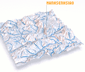 Places with similar names to Mān Hsenhsiao, Myanmar ::
// Muñosancho (ES)
Disclaimer :: Information on this page comes without warranty of any kind |
||
|
Where is Mān Hsenhsiao? Elevation and coordinates ::
Latitude (lat): 23°27'0"N Longitude (lon): 98°38'0"E
Elevation (approx.): 1285m (map arrows pan, magnifying glasses zoom) |
||
|
Visiting Mān Hsenhsiao? Hotel/Accommodation ::
Book a hotel in Mān Hsenhsiao Travel Guide ::
Buy a travel guide for Myanmar rental cars ::
car rental offers GPS waypoint ::
download a GPX waypoint (PoI) of Mān Hsenhsiao for your GPS receiver
|
||