|
search place name
|
||
Mān Ngu-löm (Shan, Myanmar)Mān Ngu-löm is a town in the Shan region of Myanmar. An overview map of the region around Mān Ngu-löm is displayed below.
regional and 3d topo map of Mān Ngu-löm, Myanmar ::

Mān Ngu-löm airports ::
The nearest airport is LSH - Lashio, located 80.4 km north of Mān Ngu-löm.
Other airports nearby include KET - Kengtung (199.2 km south east), HEH - Heho (214.7 km south west), MOG - Mong Hsat (234.7 km south east), THL - Tachilek Tachileik (281.7 km south east), Nearby towns ::
Möng Ngong (1.9km south) //
Mān Pong (4.1km north west) //
Mānpung (5.5km west) //
Kawnghsan (5.5km west) //
Hkai-lu (5.5km east) //
Mān Kyawng (6.3km north west) //
Lukkaw (6.3km south west) //
Na-hi (6.9km east) //
Honghang (7.4km south) //
Lin-ten (7.1km west) //
Kungsong (7.1km east) //
Nawngpeng (7.6km south) //
Na-ngu (7.6km north) //
Namhu (7.6km south west) //
Hpakkom (7.8km north west) //
Ho-hko (7.8km south west) //
Ta-hat (9.0km north west) //
Māklāng (10.1km north east) //
[all distances 'as the bird flies' and approximate] 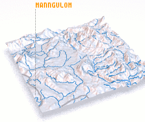 Places with similar names to Mān Ngu-löm, Myanmar ::
// Menglembu (MY)
// Mangoulima (BF)
// Mangoulma (BF)
// Mangalmé (TD)
// Monguélemba (CG)
// Mangalam (IN)
// Mangalam (IN)
// Manakkulama (LK)
// Manakkulama (LK)
// Mankulam (LK)
Disclaimer :: Information on this page comes without warranty of any kind |
||
|
Where is Mān Ngu-löm? Elevation and coordinates ::
Latitude (lat): 22°18'0"N Longitude (lon): 98°2'0"E
Elevation (approx.): 1012m (map arrows pan, magnifying glasses zoom) |
||
|
Visiting Mān Ngu-löm? Hotel/Accommodation ::
Book a hotel in Mān Ngu-löm Travel Guide ::
Buy a travel guide for Myanmar rental cars ::
car rental offers GPS waypoint ::
download a GPX waypoint (PoI) of Mān Ngu-löm for your GPS receiver
|
||