|
search place name
|
||
Man-pen-kang (Shan, Myanmar)Man-pen-kang is a town in the Shan region of Myanmar. An overview map of the region around Man-pen-kang is displayed below.
regional and 3d topo map of Man-pen-kang, Myanmar ::

Man-pen-kang airports ::
The nearest airport is LSH - Lashio, located 107.3 km north of Man-pen-kang.
Other airports nearby include HEH - Heho (180.5 km south west), KET - Kengtung (197.9 km south east), MDL - Mandalay Intl (200.0 km west), MOG - Mong Hsat (218.9 km south east), Nearby towns ::
Mān Lawk (0.0km north) //
Hsentaw (1.9km north) //
Kawngkai (1.7km west) //
Wān-pen (2.5km south west) //
Mān Hpwa (2.5km south east) //
Pinghsai (3.4km west) //
Tonhsan (3.4km east) //
Nawnghwi (3.4km east) //
Pang-mo (3.7km south) //
Mongnwi (4.1km north west) //
Pangsam (3.9km north west) //
Namhu (4.1km north east) //
Maklang (4.1km north east) //
Mān Sanlik (3.9km south west) //
Namkat (3.9km north east) //
Na-yok (4.1km south west) //
Hpa-law (4.1km south east) //
Kunti (5.1km north west) //
Mān Loi-kyawng (5.1km south west) //
Na-tai (5.1km south west) //
Namkit (5.8km south) //
Könghkam (6.5km south west) //
Nam-ta-lawn (6.5km south east) //
Hwe-kut (7.4km north) //
Nā-nai (6.9km west) //
Namhawk (6.9km east) //
Mān Kyawng (7.1km east) //
Wān Pangsong (7.6km south) //
Namhsa-yawng (7.6km south) //
[all distances 'as the bird flies' and approximate] 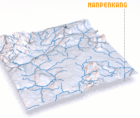 Places with similar names to Man-pen-kang, Myanmar ::
// Mān Pangngū (MM)
Disclaimer :: Information on this page comes without warranty of any kind |
||
|
Where is Man-pen-kang? Elevation and coordinates ::
Latitude (lat): 22°1'0"N Longitude (lon): 97°53'0"E
Elevation (approx.): 904m (map arrows pan, magnifying glasses zoom) |
||
|
Visiting Man-pen-kang? Hotel/Accommodation ::
Book a hotel in Man-pen-kang Travel Guide ::
Buy a travel guide for Myanmar rental cars ::
car rental offers GPS waypoint ::
download a GPX waypoint (PoI) of Man-pen-kang for your GPS receiver
|
||