|
search place name
|
||
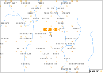
Mawhkam (Shan, Myanmar)Mawhkam is a town in the Shan region of Myanmar. An overview map of the region around Mawhkam is displayed below.
regional and 3d topo map of Mawhkam, Myanmar ::
Mawhkam airports ::
The nearest airport is MOG - Mong Hsat, located 131.6 km east of Mawhkam.
Other airports nearby include HEH - Heho (131.6 km west), KET - Kengtung (171.7 km east), THL - Tachilek Tachileik (201.0 km east), Nearby towns ::
Wo-leng (1.9km north) //
Wān Nawngkok (2.5km north west) //
Wān Kang (2.5km north west) //
Wān Longmawng (2.5km south west) //
Wān Kyawng (3.5km west) //
Wān Nawngleng (3.7km north) //
Wān Loi-hkawng (3.7km south) //
Wān Tonhong (3.9km north west) //
Linleng (3.9km north east) //
Hkö-ut-awn (5.1km north east) //
Nampu (5.1km north east) //
Wān Kyawng (5.1km south east) //
Pāngpao (5.5km east) //
Kongmon (5.8km south) //
Namhū (5.8km north) //
Pa-tüng (5.8km north) //
Wān Hai-oi (6.6km south west) //
Wān Hsim (6.6km north east) //
Nā-hpai (6.6km south east) //
Namhū-tā-hsau (7.4km north) //
Wān Kēng Hkam (7.2km east) //
Wān Hwè-pong (7.2km west) //
Konglang (7.6km south) //
Loi-lam (7.6km south) //
Loi-un (7.6km south) //
Nā-mun (7.6km north west) //
Wān Kongkeng (7.9km north east) //
Kong-ai (7.9km south east) //
Kunnā (7.9km south east) //
[all distances 'as the bird flies' and approximate]  Places with similar names to Mawhkam, Myanmar ::
Disclaimer :: Information on this page comes without warranty of any kind |
||
|
Where is Mawhkam? Elevation and coordinates ::
Latitude (lat): 20°52'0"N Longitude (lon): 98°3'0"E
Elevation (approx.): 1075m (map arrows pan, magnifying glasses zoom) |
||
|
Visiting Mawhkam? Hotel/Accommodation ::
Book a hotel in Mawhkam Travel Guide ::
Buy a travel guide for Myanmar rental cars ::
car rental offers GPS waypoint ::
download a GPX waypoint (PoI) of Mawhkam for your GPS receiver
|
||