|
search place name
|
||
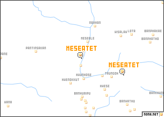
Mèsè Atet (Kayah, Myanmar)Mèsè Atet is a town in the Kayah region of Myanmar. An overview map of the region around Mèsè Atet is displayed below.
regional and 3d topo map of Mèsè Atet, Myanmar ::
Mèsè Atet airports ::
The nearest airport is LPT - Lampang, located 199.2 km east of Mèsè Atet.
Other airports nearby include RGN - Yangon Intl (250.9 km south west), MOG - Mong Hsat (266.9 km north east), Nearby towns ::
Hweponglaung (1.7km south) //
Mèsè Ywathit (1.7km north) //
Mèsè Ale (4.0km north) //
Hwunhose (4.7km south) //
Mèsè Auk (6.0km south east) //
Hwenokkut (6.2km south west) //
Namman (7.9km north) //
Taungoh (7.8km south east) //
Ban Huai Pu (8.9km south) //
Hwese (8.7km south east) //
Ban Mae Po (10.0km south east) //
[all distances 'as the bird flies' and approximate] 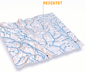 Places with similar names to Mèsè Atet, Myanmar ::
Disclaimer :: Information on this page comes without warranty of any kind |
||
|
Where is Mèsè Atet? Elevation and coordinates ::
Latitude (lat): 18°38'26"N Longitude (lon): 97°39'32"E
Elevation (approx.): 456m (map arrows pan, magnifying glasses zoom) |
||
|
Visiting Mèsè Atet? Hotel/Accommodation ::
Book a hotel in Mèsè Atet Travel Guide ::
Buy a travel guide for Myanmar rental cars ::
car rental offers GPS waypoint ::
download a GPX waypoint (PoI) of Mèsè Atet for your GPS receiver
|
||