|
search place name
|
||
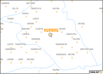
Murang (Chin, Myanmar)Murang is a town in the Chin region of Myanmar. An overview map of the region around Murang is displayed below.
regional and 3d topo map of Murang, Myanmar ::
Murang airports ::
The nearest airport is AJL - Aizwal Aizawl, located 142.3 km north west of Murang.
Other airports nearby include IMF - Imphal (206.1 km north), IXH - Kailashahar (244.3 km north west), CXB - Cox's Bazar Coxs Bazar (252.1 km south west), Nearby towns ::
Klortang (3.9km north west) //
Klorzan (3.9km north east) //
Kuangdawn (5.0km south east) //
Kaurang (5.4km west) //
Khupleng (6.8km east) //
Khuahlon (7.6km south west) //
Lumte (7.6km north west) //
Hairawn (7.8km south east) //
Vaniam (7.8km north west) //
Hmungsom (8.2km south east) //
Haitar (10.1km south east) //
[all distances 'as the bird flies' and approximate]  Places with similar names to Murang, Myanmar ::
Disclaimer :: Information on this page comes without warranty of any kind |
||
|
Where is Murang? Elevation and coordinates ::
Latitude (lat): 22°54'0"N Longitude (lon): 93°51'0"E
Elevation (approx.): 1143m (map arrows pan, magnifying glasses zoom) |
||
|
Visiting Murang? Hotel/Accommodation ::
Book a hotel in Murang Travel Guide ::
Buy a travel guide for Myanmar rental cars ::
car rental offers GPS waypoint ::
download a GPX waypoint (PoI) of Murang for your GPS receiver
|
||