|
search place name
|
||
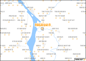
Nagadwin (Sagaing, Myanmar)Nagadwin is a town in the Sagaing region of Myanmar. An overview map of the region around Nagadwin is displayed below.
regional and 3d topo map of Nagadwin, Myanmar ::
Nagadwin airports ::
The nearest airport is MDL - Mandalay Intl, located 89.9 km south east of Nagadwin.
Other airports nearby include HEH - Heho (219.3 km south east), Nearby towns ::
Ledaw (1.9km south) //
Buba (1.9km south) //
Sulegon (1.9km north) //
Myintha (1.9km north) //
Tanaungdaw (1.9km north) //
Myenè (2.5km north east) //
Nyaungbyubin (3.7km south) //
Ma-u (3.7km north) //
Kyabaing (3.4km east) //
Tèzu (4.1km south west) //
Tawbu (3.9km south east) //
Tanaungwun (3.9km north east) //
Kyehmon (5.2km east) //
Monywe (5.2km east) //
Mayogon (5.6km south) //
Aungtha (5.6km north) //
Wègyi (5.5km west) //
Kyaungywa (7.4km south) //
Lèzin (7.4km north) //
Bono (7.6km south) //
Bônmano (7.6km south) //
Tanzin (7.1km west) //
Letkokpin (7.1km west) //
Ton (7.1km west) //
Tandawgyi (7.1km west) //
Kanbyagale (7.6km north) //
Thetkègyin (7.6km north) //
Segyidaw (7.6km north east) //
Dudauk (7.8km south west) //
[all distances 'as the bird flies' and approximate]  Places with similar names to Nagadwin, Myanmar ::
// Nagadwin (MM)
// Ngatwin (MM)
// Neu Kätwin (DE)
// Ngudwini (ZA)
// Ngadiwano (ID)
// Nagaadweyne (SO)
Disclaimer :: Information on this page comes without warranty of any kind |
||
|
Where is Nagadwin? Elevation and coordinates ::
Latitude (lat): 22°2'0"N Longitude (lon): 95°11'0"E
Elevation (approx.): 71m (map arrows pan, magnifying glasses zoom) |
||
|
Visiting Nagadwin? Hotel/Accommodation ::
Book a hotel in Nagadwin Travel Guide ::
Buy a travel guide for Myanmar rental cars ::
car rental offers GPS waypoint ::
download a GPX waypoint (PoI) of Nagadwin for your GPS receiver
|
||