|
search place name
|
||
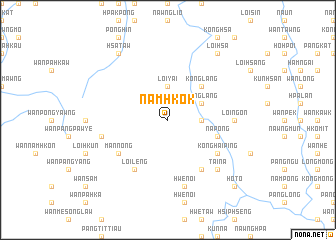
Namhkok (Shan, Myanmar)Namhkok is a town in the Shan region of Myanmar. An overview map of the region around Namhkok is displayed below.
regional and 3d topo map of Namhkok, Myanmar ::
Namhkok airports ::
The nearest airport is LSH - Lashio, located 128.7 km north of Namhkok.
Other airports nearby include HEH - Heho (142.8 km south west), MDL - Mandalay Intl (161.5 km west), MOG - Mong Hsat (230.8 km south east), Nearby towns ::
Loi-yai (3.7km north) //
Pangsamhkam (3.4km east) //
Pāngkyehtu (3.4km east) //
Konglang (3.9km north east) //
Konglang (5.1km north east) //
Nā-pong (5.5km east) //
Mān Law (6.4km south west) //
Mān Nong (6.4km south west) //
Man Chengnoi (6.5km south west) //
Loi-leng (6.5km south west) //
Konghai-ping (6.4km south east) //
Nā-hi (6.5km south east) //
Loi-ngon (6.9km east) //
Nawngsamhpo (7.1km west) //
Hwè-noi (7.6km south) //
Tai-na (7.6km south east) //
Hsa-taw (9.0km north west) //
Pa-mawng (9.0km north west) //
Loi-hsa (9.0km north east) //
Nam-kom (10.1km south east) //
Ho-to (10.1km south east) //
[all distances 'as the bird flies' and approximate]  Places with similar names to Namhkok, Myanmar ::
// Namakauk (MM)
// Nā-makhkaw (MM)
// Nā-makhkaw (MM)
// Namhkek (MM)
// Namhkok (MM)
// Namhkok (MM)
// Namkak (MM)
// Nammawhkü Ga (MM)
// Niemegk (DE)
// Niemegk (DE)
Disclaimer :: Information on this page comes without warranty of any kind |
||
|
Where is Namhkok? Elevation and coordinates ::
Latitude (lat): 21°50'0"N Longitude (lon): 97°32'0"E
Elevation (approx.): 1393m (map arrows pan, magnifying glasses zoom) |
||
|
Visiting Namhkok? Hotel/Accommodation ::
Book a hotel in Namhkok Travel Guide ::
Buy a travel guide for Myanmar rental cars ::
car rental offers GPS waypoint ::
download a GPX waypoint (PoI) of Namhkok for your GPS receiver
|
||