|
search place name
|
||
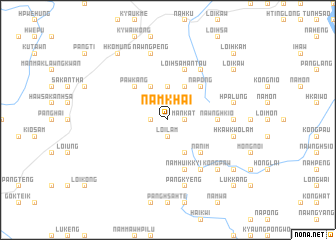
Namkhai (Shan, Myanmar)Namkhai is a town in the Shan region of Myanmar. An overview map of the region around Namkhai is displayed below.
regional and 3d topo map of Namkhai, Myanmar ::
Namkhai airports ::
The nearest airport is LSH - Lashio, located 92.7 km north east of Namkhai.
Other airports nearby include MDL - Mandalay Intl (138.5 km south west), HEH - Heho (188.9 km south), Nearby towns ::
Loi-lam (1.9km south) //
Pānglaw (1.7km east) //
Mānkāt (1.7km east) //
Nampawt (1.7km west) //
Nampawthawnghsanggu (3.7km north) //
Nampawt (4.1km south east) //
Nampyen (4.1km north east) //
Nahtun (4.1km north west) //
Nānim (5.0km south east) //
Nā-pöng (5.0km north east) //
Pawk-ang (5.0km north west) //
Naunghkam (5.1km east) //
Nawnghkio (5.1km east) //
Namhu-ikkyi (5.8km south) //
Loi-hsamantau (5.8km north) //
Wolöng (6.5km south east) //
Napeng (6.5km north east) //
Namhu (6.9km east) //
Pāngkyeng (7.6km south) //
Hkawkwolam (7.1km east) //
Hpā-lüng (7.1km east) //
Nawngpeng (7.6km north) //
Köngpaw (7.6km south east) //
Loi-hsahtè (8.8km north east) //
Mānmaö (8.8km south east) //
Loi-kaw (8.8km north east) //
Hkomung (9.0km north west) //
Pāngkyeng (10.1km south east) //
Lukkāng (10.1km south east) //
[all distances 'as the bird flies' and approximate]  Places with similar names to Namkhai, Myanmar ::
Disclaimer :: Information on this page comes without warranty of any kind |
||
|
Where is Namkhai? Elevation and coordinates ::
Latitude (lat): 22°26'0"N Longitude (lon): 97°4'0"E
Elevation (approx.): 1033m (map arrows pan, magnifying glasses zoom) |
||
|
Visiting Namkhai? Hotel/Accommodation ::
Book a hotel in Namkhai Travel Guide ::
Buy a travel guide for Myanmar rental cars ::
car rental offers GPS waypoint ::
download a GPX waypoint (PoI) of Namkhai for your GPS receiver
|
||