|
search place name
|
||
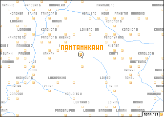
Namtamhkawn (Shan, Myanmar)Namtamhkawn is a town in the Shan region of Myanmar. An overview map of the region around Namtamhkawn is displayed below.
regional and 3d topo map of Namtamhkawn, Myanmar ::
Namtamhkawn airports ::
The nearest airport is LSH - Lashio, located 82.6 km north of Namtamhkawn.
Other airports nearby include MDL - Mandalay Intl (187.3 km west), HEH - Heho (189.6 km south west), KET - Kengtung (225.2 km south east), MOG - Mong Hsat (249.4 km south east), Nearby towns ::
Mān Loi-pan (1.9km south) //
Hwe-hko (3.9km north west) //
Hwe-hko (5.1km north west) //
Mān-mawn (5.5km west) //
Ho-tem (5.8km north) //
Loi-mengmon (5.8km north) //
Mān Hpa-leng (5.8km south) //
Nam-hkam (6.5km north west) //
Maw-hek (6.3km north east) //
Nawngpan (6.3km north east) //
Nawngsom (6.3km north east) //
Wakhak (6.9km west) //
Kunti (6.9km east) //
Ngong-sang (7.1km west) //
Hwe-pen (7.1km east) //
Pānghsang (7.6km north east) //
Lukhpakha (7.6km south west) //
Loi-hep (7.6km south east) //
Pāngmöng (7.8km north west) //
Peng-nyawng (7.8km north east) //
Na-hi (7.8km north east) //
Kong-mong (8.8km north west) //
Hkokeüng (8.8km north east) //
Pang-lashio (8.8km north east) //
Nam-un (9.0km north west) //
Nā-lun (10.1km south east) //
Ye-kan (10.1km south west) //
Mān Pan (10.1km north east) //
Kongmong (10.1km north east) //
[all distances 'as the bird flies' and approximate]  Places with similar names to Namtamhkawn, Myanmar :: Disclaimer :: Information on this page comes without warranty of any kind |
||
|
Where is Namtamhkawn? Elevation and coordinates ::
Latitude (lat): 22°14'0"N Longitude (lon): 97°42'0"E
Elevation (approx.): 1535m (map arrows pan, magnifying glasses zoom) |
||
|
Visiting Namtamhkawn? Hotel/Accommodation ::
Book a hotel in Namtamhkawn Travel Guide ::
Buy a travel guide for Myanmar rental cars ::
car rental offers GPS waypoint ::
download a GPX waypoint (PoI) of Namtamhkawn for your GPS receiver
|
||