|
search place name
|
||
Naülöng (Shan, Myanmar)Naülöng is a town in the Shan region of Myanmar. An overview map of the region around Naülöng is displayed below.
regional and 3d topo map of Naülöng, Myanmar ::

Naülöng airports ::
The nearest airport is LSH - Lashio, located 76.8 km north east of Naülöng.
Other airports nearby include MDL - Mandalay Intl (162.0 km south west), HEH - Heho (190.7 km south), MOG - Mong Hsat (284.8 km south east), Nearby towns ::
Küt-awn (1.9km north) //
Hona (1.9km north) //
Hsönkwè (1.7km west) //
Nā-makhkaw (1.7km west) //
Nawngnam (2.5km south east) //
Sè-yau (2.5km north west) //
Nānio (3.7km south) //
Tönkeng (3.7km north) //
Nā-makhkaw (3.9km north east) //
Sanghse (4.1km north east) //
Māntap (3.9km north west) //
Mān Hom (3.9km north west) //
Mengleüng (5.0km north east) //
Töng-kwang (5.1km west) //
Hpapyik (5.1km west) //
Hkompen (5.1km west) //
Sawpaw (5.5km west) //
Nahpong (5.5km west) //
Hsunpu (5.8km south) //
Pāngwo (5.8km north) //
Maksawk (5.5km east) //
Hokum (5.5km west) //
Nāsalawng (5.8km south) //
Namsaw (6.3km north east) //
Hkai-aw (6.3km north east) //
Hönghkam (6.3km north east) //
Nawngmawn (6.9km east) //
Hunan (7.6km south) //
Könghsān (7.1km east) //
[all distances 'as the bird flies' and approximate] 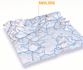 Places with similar names to Naülöng, Myanmar ::
Disclaimer :: Information on this page comes without warranty of any kind |
||
|
Where is Naülöng? Elevation and coordinates ::
Latitude (lat): 22°23'0"N Longitude (lon): 97°22'0"E
Elevation (approx.): 564m (map arrows pan, magnifying glasses zoom) |
||
|
Visiting Naülöng? Hotel/Accommodation ::
Book a hotel in Naülöng Travel Guide ::
Buy a travel guide for Myanmar rental cars ::
car rental offers GPS waypoint ::
download a GPX waypoint (PoI) of Naülöng for your GPS receiver
|
||