|
search place name
|
||
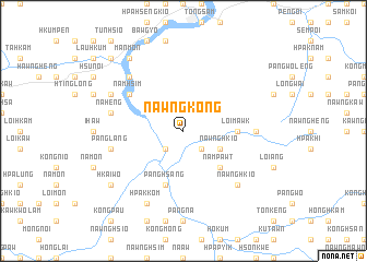
Nawngkong (Shan, Myanmar)Nawngkong is a town in the Shan region of Myanmar. An overview map of the region around Nawngkong is displayed below.
regional and 3d topo map of Nawngkong, Myanmar ::
Nawngkong airports ::
The nearest airport is LSH - Lashio, located 71.6 km north east of Nawngkong.
Other airports nearby include MDL - Mandalay Intl (161.1 km south west), HEH - Heho (200.7 km south), MOG - Mong Hsat (300.0 km south east), Nearby towns ::
Onghkök (2.5km south west) //
Tütan (2.5km south east) //
Nawngmün (2.5km south east) //
Nawnghkio (3.9km south east) //
Nampawt (5.0km south east) //
Loi-mawk (5.1km east) //
Pānghsāng (5.8km south) //
Namhsim (6.3km north west) //
Loi-kaw (6.8km east) //
Nā-heng (7.1km west) //
Mān Mao (7.1km west) //
Pānglang (7.1km west) //
Pāngyaung (7.6km north west) //
Nawnghkio (7.6km south east) //
Tunhsao (7.8km north west) //
Hönlom (8.2km south west) //
Hpak-kom (8.2km south west) //
Hkaiwo (8.8km south west) //
Mānmon (9.0km north west) //
Te-san (10.1km north west) //
[all distances 'as the bird flies' and approximate]  Places with similar names to Nawngkong, Myanmar ::
// Nangkawng (MM)
// Nangking (MM)
// Naungkaing (MM)
// Nawngkang (MM)
// Nawngkawng (MM)
// Nawngkawng (MM)
// Nawngkeng (MM)
// Nawngkeng (MM)
// Nông Cống (VN)
// Ningqiang (CN)
Disclaimer :: Information on this page comes without warranty of any kind |
||
|
Where is Nawngkong? Elevation and coordinates ::
Latitude (lat): 22°30'0"N Longitude (lon): 97°17'0"E
Elevation (approx.): 540m (map arrows pan, magnifying glasses zoom) |
||
|
Visiting Nawngkong? Hotel/Accommodation ::
Book a hotel in Nawngkong Travel Guide ::
Buy a travel guide for Myanmar rental cars ::
car rental offers GPS waypoint ::
download a GPX waypoint (PoI) of Nawngkong for your GPS receiver
|
||