|
search place name
|
||
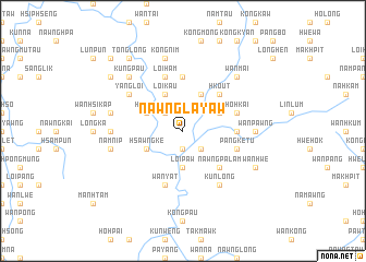
Nawngla-yaw (Shan, Myanmar)Nawngla-yaw is a town in the Shan region of Myanmar. An overview map of the region around Nawngla-yaw is displayed below.
regional and 3d topo map of Nawngla-yaw, Myanmar ::
Nawngla-yaw airports ::
The nearest airport is HEH - Heho, located 138.5 km south west of Nawngla-yaw.
Other airports nearby include LSH - Lashio (148.9 km north), MDL - Mandalay Intl (181.8 km west), KET - Kengtung (200.6 km east), MOG - Mong Hsat (200.9 km south east), Nearby towns ::
Wān Hkam (1.9km south) //
Loi-lam (1.9km south) //
Wan Loi (2.5km north west) //
Yanghkam (2.5km south east) //
Loi-paw (3.7km south) //
Wān Möng (3.7km south) //
Hpa-wan (3.7km south) //
Hsawngke (3.9km south west) //
Nā-hkan (3.9km north west) //
Hpā-mai (3.9km north west) //
Loi-kau (4.1km north west) //
Tawnglum (4.1km north east) //
Wān Köngnö-hpoi (3.9km north east) //
Nawngpa-lam (5.1km south east) //
Hko-ut (5.1km north east) //
Wān Hwe (5.2km east) //
Pang-lawn (5.2km east) //
Konghsa (5.6km north) //
Pangke-tu (5.5km east) //
Wān Yat (5.8km south) //
Loi-ham (5.8km north) //
Ho-hkai (5.5km east) //
Yangloi (6.4km north west) //
Nawng-myīn (6.5km south east) //
Kunlong (6.5km south east) //
Nam-hku (6.9km west) //
Wān Pawng (6.9km east) //
Namnip (7.1km west) //
Panghpit (7.1km west) //
[all distances 'as the bird flies' and approximate] 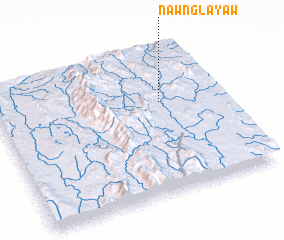 Places with similar names to Nawngla-yaw, Myanmar :: Disclaimer :: Information on this page comes without warranty of any kind |
||
|
Where is Nawngla-yaw? Elevation and coordinates ::
Latitude (lat): 21°38'0"N Longitude (lon): 97°44'0"E
Elevation (approx.): 1021m (map arrows pan, magnifying glasses zoom) |
||
|
Visiting Nawngla-yaw? Hotel/Accommodation ::
Book a hotel in Nawngla-yaw Travel Guide ::
Buy a travel guide for Myanmar rental cars ::
car rental offers GPS waypoint ::
download a GPX waypoint (PoI) of Nawngla-yaw for your GPS receiver
|
||