|
search place name
|
||
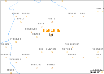
Ngalang (Kachin State, Myanmar)Ngalang is a town in the Kachin State region of Myanmar. An overview map of the region around Ngalang is displayed below.
regional and 3d topo map of Ngalang, Myanmar ::
Ngalang airports ::
The nearest airport is PBU - Putao, located 62.1 km north west of Ngalang.
Other airports nearby include MYT - Myitkyina (177.0 km south), Nearby towns ::
Pinya (5.0km north west) //
Nawt Ga (5.0km west) //
Yangtu (5.6km north) //
'Ndawyang (5.6km south) //
'Nkim (6.5km south west) //
Shayang Ga (6.9km west) //
Shatum Ga (7.4km south east) //
Sumlangyang (7.6km south east) //
Pinma Ga (9.9km north east) //
'Npau Uma (9.9km south east) //
[all distances 'as the bird flies' and approximate]  Places with similar names to Ngalang, Myanmar ::
// Na-hkau-long (MM)
// Ngahlaing (MM)
// Ngalang Ga (MM)
// Ngālang Ga (MM)
// Ngālang Ga (MM)
// Ngaleng (MM)
// Ngalu-aing (MM)
// Ngalung Ga (MM)
// Neuglienicke (DE)
// Na Klang (TH)
Disclaimer :: Information on this page comes without warranty of any kind |
||
|
Where is Ngalang? Elevation and coordinates ::
Latitude (lat): 26°55'0"N Longitude (lon): 97°51'0"E
Elevation (approx.): 993m (map arrows pan, magnifying glasses zoom) |
||
|
Visiting Ngalang? Hotel/Accommodation ::
Book a hotel in Ngalang Travel Guide ::
Buy a travel guide for Myanmar rental cars ::
car rental offers GPS waypoint ::
download a GPX waypoint (PoI) of Ngalang for your GPS receiver
|
||