|
search place name
|
||
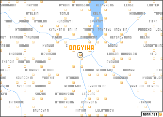
Ongyiwa (Shan, Myanmar)Ongyiwa is a town in the Shan region of Myanmar. An overview map of the region around Ongyiwa is displayed below.
regional and 3d topo map of Ongyiwa, Myanmar ::
Ongyiwa airports ::
The nearest airport is HEH - Heho, located 37.8 km north of Ongyiwa.
Other airports nearby include MDL - Mandalay Intl (170.6 km north west), Nearby towns ::
Sizon (0.0km north) //
Ywaganlan (1.9km south) //
Zibingon (2.5km north west) //
Maingpyo (2.5km north east) //
Magyizeik (2.5km south west) //
Inbawhkon (4.1km north east) //
Inya (4.1km south east) //
Loi-maw (4.1km south east) //
Nadaunggya (5.1km north west) //
Nampan (5.1km north east) //
Sedanbauk (5.1km south east) //
Htihkan (5.8km south) //
Sawma (5.8km north) //
Ywagyi (5.8km north) //
Indein (6.4km north west) //
Panbyin (6.4km north east) //
Myebya (6.4km south west) //
Peinnegon (6.4km south east) //
Ingyingon (6.9km west) //
Longon (6.9km east) //
Kyadun (7.2km west) //
Ywama (7.6km north) //
Thale (7.6km north) //
Dada-u (7.2km east) //
Peinnegon (7.6km south) //
Bankan (7.6km south) //
Pyadein (7.2km east) //
Kyainggan (7.6km south) //
Kyauktaw (7.6km north west) //
[all distances 'as the bird flies' and approximate]  Places with similar names to Ongyiwa, Myanmar :: Disclaimer :: Information on this page comes without warranty of any kind |
||
|
Where is Ongyiwa? Elevation and coordinates ::
Latitude (lat): 20°25'0"N Longitude (lon): 96°53'0"E
Elevation (approx.): 885m (map arrows pan, magnifying glasses zoom) |
||
|
Visiting Ongyiwa? Hotel/Accommodation ::
Book a hotel in Ongyiwa Travel Guide ::
Buy a travel guide for Myanmar rental cars ::
car rental offers GPS waypoint ::
download a GPX waypoint (PoI) of Ongyiwa for your GPS receiver
|
||