|
search place name
|
||
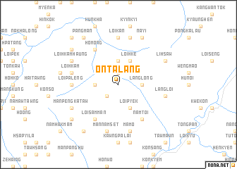
Ontaláng (Shan, Myanmar)Ontaláng is a town in the Shan region of Myanmar. An overview map of the region around Ontaláng is displayed below.
regional and 3d topo map of Ontaláng, Myanmar ::
Ontaláng airports ::
The nearest airport is LSH - Lashio, located 86.6 km east of Ontaláng.
Other airports nearby include MDL - Mandalay Intl (161.2 km south west), Nearby towns ::
Pàngsat (1.9km north) //
Kawnhsilám (2.5km south west) //
Pángkwai (3.7km north) //
Lánglong (3.4km east) //
Pánglom (3.4km west) //
Loihke (4.1km north east) //
Loipyek (4.1km south east) //
Namtoi (6.5km south east) //
Loisammán (6.5km south west) //
Mánkyán (6.5km north west) //
Homöng (6.5km north west) //
Loikan (7.4km north) //
Pángkaw (6.8km west) //
Loipaleng (6.8km west) //
Kuinkuiloi (7.6km north) //
Langloi (7.1km east) //
Loi-hkam (7.1km west) //
Mamo (7.6km south) //
Mánkáng (7.6km south) //
Mannamset (7.6km south) //
Lihsaw (7.8km north east) //
Nayi (8.2km north east) //
Mánmwe (8.2km north east) //
Loihkamhaung (7.8km north west) //
Mànkàng (7.8km north west) //
Mánpengkataw (7.8km south west) //
Pángman (9.0km north west) //
Mánloipántang (9.0km south west) //
Pánghkáiloi (8.8km north west) //
[all distances 'as the bird flies' and approximate] 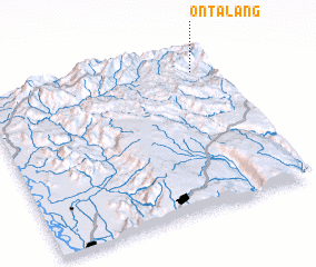 Places with similar names to Ontaláng, Myanmar :: Disclaimer :: Information on this page comes without warranty of any kind |
||
|
Where is Ontaláng? Elevation and coordinates ::
Latitude (lat): 22°52'0"N Longitude (lon): 96°55'0"E
Elevation (approx.): 1588m (map arrows pan, magnifying glasses zoom) |
||
|
Visiting Ontaláng? Hotel/Accommodation ::
Book a hotel in Ontaláng Travel Guide ::
Buy a travel guide for Myanmar rental cars ::
car rental offers GPS waypoint ::
download a GPX waypoint (PoI) of Ontaláng for your GPS receiver
|
||