|
search place name
|
||
Palandaw (Myanmar)Palandaw is a town in Myanmar. An overview map of the region around Palandaw is displayed below.
regional and 3d topo map of Palandaw, Myanmar ::

Palandaw airports ::
The nearest airport is KYP - Kyaukpyu, located 158.7 km south west of Palandaw.
Other airports nearby include AKY - Sittwe (196.9 km west), MDL - Mandalay Intl (202.4 km north east), SNW - Thandwe (207.2 km south), Nearby towns ::
Legaing (1.9km north) //
Lezwe (1.7km west) //
Ondaw (1.9km north) //
Kyauksitpon (1.7km east) //
Bandan (2.5km south west) //
Meyin (2.5km south west) //
Thigon (2.5km south west) //
Minhlagon (3.5km east) //
Natha (3.5km west) //
Hlegyi (3.7km north) //
Nabegon (3.9km south west) //
Paungywa (3.9km south west) //
Bawdigon (3.9km north west) //
Nyaunggon (4.1km south west) //
Tanaungdaw (4.1km south east) //
Bonmano (4.1km south west) //
Lehlagon (4.1km north west) //
Kanzwe (4.1km north east) //
Zetagu (4.1km north east) //
Kangon (5.1km south west) //
Kadi (5.1km south east) //
Kangala (5.2km east) //
Pauktawgyi (5.8km south) //
Theingon (5.8km south) //
Pyinba (5.8km south) //
Magyigyaung (6.4km south west) //
Thigon (6.4km south west) //
Sagu (7.6km south) //
Saga (7.6km south) //
[all distances 'as the bird flies' and approximate] 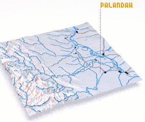 Places with similar names to Palandaw, Myanmar ::
Disclaimer :: Information on this page comes without warranty of any kind |
||
|
Where is Palandaw? Elevation and coordinates ::
Latitude (lat): 20°17'0"N Longitude (lon): 94°45'0"E
Elevation (approx.): 50m (map arrows pan, magnifying glasses zoom) |
||
|
Visiting Palandaw? Hotel/Accommodation ::
Book a hotel in Palandaw Travel Guide ::
Buy a travel guide for Myanmar rental cars ::
car rental offers GPS waypoint ::
download a GPX waypoint (PoI) of Palandaw for your GPS receiver
|
||