|
search place name
|
||
Pangngang (Shan, Myanmar)Pangngang is a town in the Shan region of Myanmar. An overview map of the region around Pangngang is displayed below.
regional and 3d topo map of Pangngang, Myanmar ::

Pangngang airports ::
The nearest airport is HEH - Heho, located 105.1 km north west of Pangngang.
Other airports nearby include MOG - Mong Hsat (170.3 km east), MDL - Mandalay Intl (236.8 km north west), KET - Kengtung (237.3 km north east), LPT - Lampang (293.2 km south east), Nearby towns ::
Namkat (2.5km north east) //
Kongyai (4.1km north east) //
Wān Ponglao (3.9km south east) //
Wān Pangmawng (4.1km south west) //
Sa-ti-long (3.9km north west) //
Pāngkwe (5.1km north west) //
Wān Loi-lim (5.5km east) //
Wān Pāngwo (5.8km south) //
Wān Kongpao (6.4km south east) //
Wān Ho-pong (6.6km south east) //
Nammawwan (6.4km north west) //
Namlin (7.4km north) //
Nā-hsai (7.0km east) //
Makmong (7.0km east) //
Makmonglau (7.2km east) //
Wān Pu-sang (7.6km south east) //
Konglong (7.6km north west) //
Wān Ho-nawng (8.2km south east) //
Shwe-lambo-yat (7.9km south east) //
Wānkun (7.9km north east) //
Wān Kyawng (7.9km north east) //
Nawnghang (7.9km north east) //
Wān Kyawng (9.1km north east) //
Kongsa (9.1km south east) //
Wān Kong (9.1km south east) //
Wān Nammawwān (8.9km south east) //
Hona (8.9km north east) //
[all distances 'as the bird flies' and approximate] 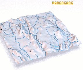 Places with similar names to Pangngang, Myanmar ::
// Hpunggankawng (MM)
Disclaimer :: Information on this page comes without warranty of any kind |
||
|
Where is Pangngang? Elevation and coordinates ::
Latitude (lat): 20°15'0"N Longitude (lon): 97°39'0"E
Elevation (approx.): 854m (map arrows pan, magnifying glasses zoom) |
||
|
Visiting Pangngang? Hotel/Accommodation ::
Book a hotel in Pangngang Travel Guide ::
Buy a travel guide for Myanmar rental cars ::
car rental offers GPS waypoint ::
download a GPX waypoint (PoI) of Pangngang for your GPS receiver
|
||