|
search place name
|
||
Pēte (Myanmar)Pēte is a town in Myanmar. An overview map of the region around Pēte is displayed below.
regional and 3d topo map of Pēte, Myanmar ::

Pēte airports ::
The nearest airport is RGN - Yangon Intl, located 133.3 km south west of Pēte.
Nearby towns ::
Ya-okhi (2.6km south west) //
Winkadeik (2.6km south east) //
Lower Natkyi (4.1km south east) //
Hpale (4.0km south east) //
Bawpawta (4.1km north east) //
Asuchaung (4.0km north east) //
Ayodaung (5.1km south west) //
Kluthawlaw (5.1km north east) //
Shwelaung-in (5.6km south) //
Takawhta (5.8km north) //
Bôklaw (5.8km north) //
Wi-Aseik (5.8km south) //
Melaung (6.6km south west) //
Kwikyawla (6.5km south east) //
Talawkwi (6.5km north east) //
Kerserhpo (6.6km north east) //
Mawkhi (7.1km east) //
Pyintha (7.6km south) //
Yewe-auk (7.3km west) //
Kyauklongyi (8.2km south west) //
Meka (8.2km north west) //
Melaung (9.1km south west) //
Belanu (9.1km south east) //
Kawthiwa (9.0km south east) //
Kawthihta (9.0km south east) //
Pētewa (10.2km south west) //
[all distances 'as the bird flies' and approximate] 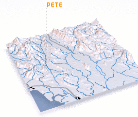 Places with similar names to Pēte, Myanmar ::
Disclaimer :: Information on this page comes without warranty of any kind |
||
|
Where is Pēte? Elevation and coordinates ::
Latitude (lat): 17°29'0"N Longitude (lon): 97°14'0"E
Elevation (approx.): 107m (map arrows pan, magnifying glasses zoom) |
||
|
Visiting Pēte? Hotel/Accommodation ::
Book a hotel in Pēte Travel Guide ::
Buy a travel guide for Myanmar rental cars ::
car rental offers GPS waypoint ::
download a GPX waypoint (PoI) of Pēte for your GPS receiver
|
||