|
search place name
|
||
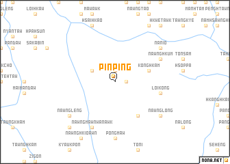
Pinping (Shan, Myanmar)Pinping is a town in the Shan region of Myanmar. An overview map of the region around Pinping is displayed below.
regional and 3d topo map of Pinping, Myanmar ::
Pinping airports ::
The nearest airport is LSH - Lashio, located 116.0 km north east of Pinping.
Other airports nearby include MDL - Mandalay Intl (119.8 km south west), HEH - Heho (160.7 km south), Nearby towns ::
Kongnyawng (1.7km east) //
Köng-gyawng (1.9km north) //
Pangpao (3.9km north west) //
Konghkam (5.5km east) //
Nyaungbintha (5.5km east) //
Naungyin (6.5km south east) //
Loi-kong (7.1km east) //
Nawngmawn Wan-awk (8.2km south west) //
Nawnghkum (7.8km north east) //
Nawnglong (8.8km south east) //
Nā-nio (8.8km north east) //
Nawngleng (8.8km south west) //
Me-pok Payagon (8.8km south west) //
Me-pok (10.1km south west) //
[all distances 'as the bird flies' and approximate] 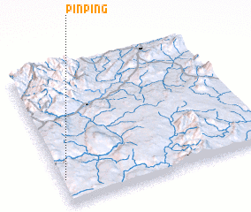 Places with similar names to Pinping, Myanmar ::
Disclaimer :: Information on this page comes without warranty of any kind |
||
|
Where is Pinping? Elevation and coordinates ::
Latitude (lat): 22°11'0"N Longitude (lon): 97°1'0"E
Elevation (approx.): 885m (map arrows pan, magnifying glasses zoom) |
||
|
Visiting Pinping? Hotel/Accommodation ::
Book a hotel in Pinping Travel Guide ::
Buy a travel guide for Myanmar rental cars ::
car rental offers GPS waypoint ::
download a GPX waypoint (PoI) of Pinping for your GPS receiver
|
||