|
search place name
|
||
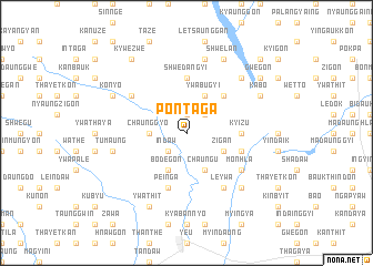
Pontaga (Sagaing, Myanmar)Pontaga is a town in the Sagaing region of Myanmar. An overview map of the region around Pontaga is displayed below.
regional and 3d topo map of Pontaga, Myanmar ::
Pontaga airports ::
The nearest airport is MDL - Mandalay Intl, located 140.6 km south east of Pontaga.
Other airports nearby include IMF - Imphal (261.7 km north west), Nearby towns ::
Hlethwin (1.9km north) //
Deyauk (1.9km north) //
Mondaingbin (2.5km north east) //
Indaw (2.5km south west) //
Chaunggyo (3.4km west) //
Ywabugyi (4.1km north east) //
Satthe (4.1km south west) //
Bodegon (4.1km south west) //
Chaung-u (4.1km south east) //
Zigan (3.9km south east) //
Tatthit (5.0km north east) //
Shanzeik (5.0km north east) //
Kyizu (5.1km east) //
Shwedangyi (5.6km north) //
Pein-ga (5.8km south) //
Pinzeingin (5.4km east) //
Kabaunggyaing (6.3km north west) //
Monhla (6.3km south east) //
Leywa (6.5km south east) //
Ngadan (7.6km north) //
Tumaung (7.1km west) //
Thawatti (7.6km south east) //
Ettaw (7.6km north east) //
Konyo (7.8km north west) //
Shwelan (8.2km north east) //
Ywathit (8.2km south west) //
Aingbyaunggyaung (7.8km north east) //
Kabo (7.8km north east) //
Kywèzwè (9.0km north west) //
[all distances 'as the bird flies' and approximate]  Places with similar names to Pontaga, Myanmar ::
// Panteik (MM)
// Pine Tuckey (US)
// Pinetucky (US)
// Pan Tak (US)
// Pentik (MY)
// Ponteggia (IT)
// Poniatówka (PL)
// Pintic (RO)
// Pintic (RO)
// Pinticu (RO)
Disclaimer :: Information on this page comes without warranty of any kind |
||
|
Where is Pontaga? Elevation and coordinates ::
Latitude (lat): 22°52'0"N Longitude (lon): 95°26'0"E
Elevation (approx.): 113m (map arrows pan, magnifying glasses zoom) |
||
|
Visiting Pontaga? Hotel/Accommodation ::
Book a hotel in Pontaga Travel Guide ::
Buy a travel guide for Myanmar rental cars ::
car rental offers GPS waypoint ::
download a GPX waypoint (PoI) of Pontaga for your GPS receiver
|
||