|
search place name
|
||
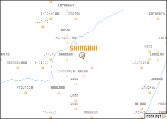
Shingbwi (Kachin State, Myanmar)Shingbwi is a town in the Kachin State region of Myanmar. An overview map of the region around Shingbwi is displayed below.
regional and 3d topo map of Shingbwi, Myanmar ::
Shingbwi airports ::
The nearest airport is MYT - Myitkyina, located 117.9 km south west of Shingbwi.
Other airports nearby include PBU - Putao (139.6 km north west), Nearby towns ::
Nawpyu (2.5km south east) //
Sharē Ga (3.3km west) //
Wāsha (3.7km south) //
Hkinjitu (4.1km north west) //
Machangting (5.0km north west) //
Chingma Ga (5.0km south west) //
Pawa (5.8km south) //
Pushe (6.5km north west) //
Lawupu (6.7km west) //
Maru Gahtawng (6.7km west) //
Nawlang (8.9km south west) //
[all distances 'as the bird flies' and approximate] 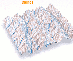 Places with similar names to Shingbwi, Myanmar ::
// Ch'angbawi (KP)
// Changbawi (KR)
// Changbawi (KR)
// Changgibawi (KR)
// Shiengbwa (LR)
// Chaungbwe (MM)
Disclaimer :: Information on this page comes without warranty of any kind |
||
|
Where is Shingbwi? Elevation and coordinates ::
Latitude (lat): 26°13'0"N Longitude (lon): 98°5'0"E
Elevation (approx.): 1117m (map arrows pan, magnifying glasses zoom) |
||
|
Visiting Shingbwi? Hotel/Accommodation ::
Book a hotel in Shingbwi Travel Guide ::
Buy a travel guide for Myanmar rental cars ::
car rental offers GPS waypoint ::
download a GPX waypoint (PoI) of Shingbwi for your GPS receiver
|
||