|
search place name
|
||
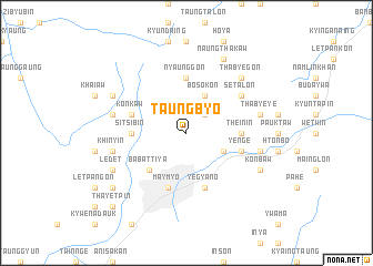
Taungbyo (Mandalay, Myanmar)Taungbyo is a town in the Mandalay region of Myanmar. An overview map of the region around Taungbyo is displayed below.
regional and 3d topo map of Taungbyo, Myanmar ::
Taungbyo airports ::
The nearest airport is MDL - Mandalay Intl, located 67.2 km south west of Taungbyo.
Other airports nearby include HEH - Heho (151.4 km south), LSH - Lashio (163.9 km north east), Nearby towns ::
Kalagon (2.5km north east) //
Myauk-taw (2.5km north east) //
Mogyo-byit (3.9km south east) //
Thet-kan-kon (4.1km north east) //
Bo-so-kôn (4.1km north east) //
Ba-battiya (5.1km south west) //
Thein-in (5.2km east) //
Sitsibin (5.2km west) //
Nyaunggon (5.6km north) //
Ye-nge (5.5km east) //
Maymyo (5.8km south) //
Puklun Palin (5.5km west) //
Konkaw (5.5km west) //
Yegyano (5.8km south) //
Se-ta-lon (6.3km north east) //
Khinyin (7.1km west) //
Panudaung (7.1km west) //
Pwekawk (7.1km east) //
Tha-bye-ye (7.1km east) //
Thabye-gon (7.6km north east) //
Sinlan (7.8km south west) //
Sin-byu-in (7.8km south west) //
Ledet (7.8km south west) //
Naungkhangyi (7.8km south west) //
Pakang (7.8km north west) //
Konbaw (7.8km south east) //
Naung-tha-kaw (8.2km north east) //
Nan-kat (8.8km south west) //
Thayetpin (10.1km south west) //
[all distances 'as the bird flies' and approximate] 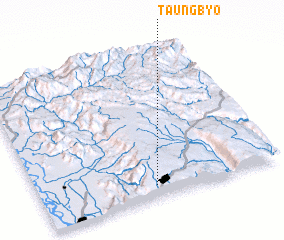 Places with similar names to Taungbyo, Myanmar ::
Disclaimer :: Information on this page comes without warranty of any kind |
||
|
Where is Taungbyo? Elevation and coordinates ::
Latitude (lat): 22°5'0"N Longitude (lon): 96°29'0"E
Elevation (approx.): 1142m (map arrows pan, magnifying glasses zoom) |
||
|
Visiting Taungbyo? Hotel/Accommodation ::
Book a hotel in Taungbyo Travel Guide ::
Buy a travel guide for Myanmar rental cars ::
car rental offers GPS waypoint ::
download a GPX waypoint (PoI) of Taungbyo for your GPS receiver
|
||