|
search place name
|
||
Tawnmawn (Shan, Myanmar)Tawnmawn is a town in the Shan region of Myanmar. An overview map of the region around Tawnmawn is displayed below.
regional and 3d topo map of Tawnmawn, Myanmar ::

Tawnmawn airports ::
The nearest airport is HEH - Heho, located 45.4 km north west of Tawnmawn.
Other airports nearby include MDL - Mandalay Intl (177.4 km north west), Nearby towns ::
Hang Loi (0.0km north) //
Hai-long (1.9km north) //
Hang Kyaung (1.9km north) //
Kongkyaung (1.7km west) //
Kyaung Me (1.9km south) //
Pa Hop (1.7km east) //
Loi-an (2.5km north west) //
Hsawtpo (3.7km north) //
Yewin (3.7km south) //
Kanlan (3.7km south) //
Taung Te (3.9km north west) //
Un Nyu (5.1km south west) //
Nampon (5.1km north east) //
Nawngwawn (5.1km south east) //
Wān Maik (5.6km south) //
Salai (5.8km south) //
Hsamsang (5.8km north) //
Ho-ti (5.5km east) //
Pa Pe Loi (5.8km north) //
Hi Li (5.8km north) //
Tama Hein (6.6km south west) //
Ho Hkai (6.4km north east) //
Möng Lun (6.4km north west) //
Kun-Na (6.4km north west) //
Hsan Sang (6.6km south east) //
Namhkok (6.6km north east) //
Kunnyawng (6.6km south east) //
Kon Sati (7.4km north) //
Kon Kawk (7.6km north) //
[all distances 'as the bird flies' and approximate] 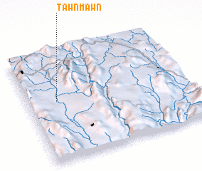 Places with similar names to Tawnmawn, Myanmar ::
// Tinaïmine (MA)
// Dinoman (PH)
// Tanamu-nao (MM)
// Tinmyne (ZA)
// Denman (US)
// Dinamani (BD)
// Danèmbana (BF)
// Donombéné (BF)
// Donommbèné (BF)
// Tanmbouana (BF)
Disclaimer :: Information on this page comes without warranty of any kind |
||
|
Where is Tawnmawn? Elevation and coordinates ::
Latitude (lat): 20°34'0"N Longitude (lon): 97°11'0"E
Elevation (approx.): 1004m (map arrows pan, magnifying glasses zoom) |
||
|
Visiting Tawnmawn? Hotel/Accommodation ::
Book a hotel in Tawnmawn Travel Guide ::
Buy a travel guide for Myanmar rental cars ::
car rental offers GPS waypoint ::
download a GPX waypoint (PoI) of Tawnmawn for your GPS receiver
|
||