|
search place name
|
||
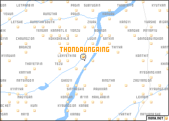
Thondaungaing (Mandalay, Myanmar)Thondaungaing is a town in the Mandalay region of Myanmar. An overview map of the region around Thondaungaing is displayed below.
regional and 3d topo map of Thondaungaing, Myanmar ::
Thondaungaing airports ::
The nearest airport is MDL - Mandalay Intl, located 59.8 km north of Thondaungaing.
Other airports nearby include HEH - Heho (103.8 km south east), LSH - Lashio (277.1 km north east), Nearby towns ::
Ywathit (1.9km north) //
Bogon (1.9km north) //
Kalaywa (1.7km east) //
Shanzu (1.9km south) //
Kyinywa (2.5km south west) //
Lemyethna (3.5km west) //
Ywadaw (3.9km north west) //
Lugin (4.1km north east) //
Nyaungbingon (5.1km north west) //
Thitpalwegan (5.6km south) //
Kanzwe (5.2km west) //
Pindale (5.5km west) //
Nyaunggan (5.8km south) //
Yonzu (5.8km north) //
Wetlet (5.8km north) //
Nyaungkaya (5.8km south) //
Tezu (5.5km west) //
Satkin (6.4km north east) //
Nebugon (6.4km north east) //
Bokkon (6.5km north east) //
Pyaswe (6.5km north east) //
Thapanbin (6.5km south west) //
Palangyin (6.5km south west) //
Shauktaw (6.5km south west) //
Nyaungdo (6.5km north west) //
Palawa (6.5km south west) //
Gwegyi (6.5km south west) //
Gwegan (6.4km north west) //
Kokkokahla (6.4km north west) //
[all distances 'as the bird flies' and approximate]  Places with similar names to Thondaungaing, Myanmar ::
// Thôn Ðông Giang (VN)
Disclaimer :: Information on this page comes without warranty of any kind |
||
|
Where is Thondaungaing? Elevation and coordinates ::
Latitude (lat): 21°10'0"N Longitude (lon): 95°54'0"E
Elevation (approx.): 156m (map arrows pan, magnifying glasses zoom) |
||
|
Visiting Thondaungaing? Hotel/Accommodation ::
Book a hotel in Thondaungaing Travel Guide ::
Buy a travel guide for Myanmar rental cars ::
car rental offers GPS waypoint ::
download a GPX waypoint (PoI) of Thondaungaing for your GPS receiver
|
||