|
search place name
|
||
Wanlo (Shan, Myanmar)Wanlo is a town in the Shan region of Myanmar. An overview map of the region around Wanlo is displayed below.
regional and 3d topo map of Wanlo, Myanmar ::

Wanlo airports ::
The nearest airport is HEH - Heho, located 127.5 km south west of Wanlo.
Other airports nearby include LSH - Lashio (167.3 km north), MDL - Mandalay Intl (185.4 km west), MOG - Mong Hsat (188.7 km south east), KET - Kengtung (196.4 km east), Nearby towns ::
Kongmehsèng (2.5km north west) //
Panghomawng (3.4km east) //
Wān Sawt (3.9km south east) //
Hpaimu (5.1km north east) //
Wān Nā (5.6km north) //
Longtang (5.2km west) //
Linlēng (5.5km west) //
Na-yawng (5.5km west) //
Pa-yang (6.5km north west) //
Nawnglong (6.5km north east) //
Ta-ra-sawn (6.4km north east) //
Takmawk (7.4km north) //
Kunhai (6.9km east) //
Mawhseng (7.1km west) //
Kuttēng (7.1km west) //
Maklang (8.2km north west) //
Namtawng (8.2km north west) //
Kun-weng (8.2km north west) //
Wānhsang (7.8km south west) //
Wānmawk (9.0km south west) //
Namhu (10.1km north west) //
Pun-wun (10.1km north west) //
Tenglok (10.1km south west) //
[all distances 'as the bird flies' and approximate] 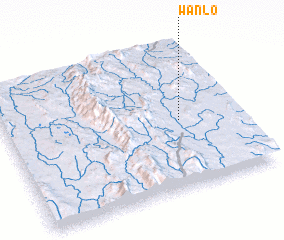 Places with similar names to Wanlo, Myanmar ::
Disclaimer :: Information on this page comes without warranty of any kind |
||
|
Where is Wanlo? Elevation and coordinates ::
Latitude (lat): 21°28'0"N Longitude (lon): 97°45'0"E
Elevation (approx.): 1000m (map arrows pan, magnifying glasses zoom) |
||
|
Visiting Wanlo? Hotel/Accommodation ::
Book a hotel in Wanlo Travel Guide ::
Buy a travel guide for Myanmar rental cars ::
car rental offers GPS waypoint ::
download a GPX waypoint (PoI) of Wanlo for your GPS receiver
|
||