|
search place name
|
||
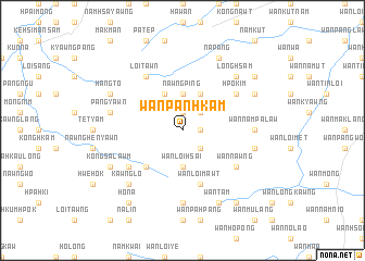
Wān Panhkam (Shan, Myanmar)Wān Panhkam is a town in the Shan region of Myanmar. An overview map of the region around Wān Panhkam is displayed below.
regional and 3d topo map of Wān Panhkam, Myanmar ::
Wān Panhkam airports ::
The nearest airport is LSH - Lashio, located 126.8 km north of Wān Panhkam.
Other airports nearby include HEH - Heho (172.5 km south west), KET - Kengtung (183.2 km east), MOG - Mong Hsat (199.3 km south east), MDL - Mandalay Intl (206.3 km west), Nearby towns ::
Wān Namtakhkek (1.7km east) //
Luklong (1.9km north) //
Namkyawng (2.5km north east) //
Wān Loi-leng (2.5km south east) //
Nawngping (3.7km north) //
Wān Loi-hsai (3.7km south) //
Maklang (4.1km north east) //
Namhsong (4.1km north east) //
Namhkai (4.1km north west) //
Mān Pāng (5.1km south west) //
Wān Loimawt (5.8km south) //
Hpo-kim (6.4km north east) //
Wān Loi-hsang (6.4km south east) //
Wān Nawng (6.4km south east) //
Nawng-hsawm (6.4km south west) //
Loi-tawn (6.5km north west) //
Wān Nampa-law (6.9km east) //
Wān Nawnghsi (7.4km south) //
Wān Loi-hpwi (7.1km east) //
Man Kong (7.1km west) //
Pangyawn (7.1km west) //
Longhsam (7.6km north east) //
Hpai Möng (7.6km south west) //
Kawng-lo (7.6km south west) //
Panglaw (7.8km north east) //
Nā-pang (8.2km north east) //
Hangto (7.8km north west) //
Kongsa-lawm (7.8km south west) //
Wān Tam (8.2km south east) //
[all distances 'as the bird flies' and approximate]  Places with similar names to Wān Panhkam, Myanmar ::
Disclaimer :: Information on this page comes without warranty of any kind |
||
|
Where is Wān Panhkam? Elevation and coordinates ::
Latitude (lat): 21°51'0"N Longitude (lon): 97°58'0"E
Elevation (approx.): 1162m (map arrows pan, magnifying glasses zoom) |
||
|
Visiting Wān Panhkam? Hotel/Accommodation ::
Book a hotel in Wān Panhkam Travel Guide ::
Buy a travel guide for Myanmar rental cars ::
car rental offers GPS waypoint ::
download a GPX waypoint (PoI) of Wān Panhkam for your GPS receiver
|
||