|
search place name
|
||
Molaogly (Abashis Raioni, Georgia)Molaogly is a town in the Abashis Raioni region of Georgia. An overview map of the region around Molaogly is displayed below.
regional and 3d topo map of Molaogly, Georgia ::

Nearby towns ::
Gulbagi (0.1km south) //
Burdadzori (2.0km south west) //
Tsopi (2.8km west) //
Sadakhlo (3.2km east) //
Damia (5.0km north) //
Khojorni (5.5km west) //
Debetashen (5.6km east) //
Verin Akhtala (7.5km south) //
Damia Giaurarkhi (7.4km north) //
Sioni (7.4km north west) //
Bagratashen (6.1km east) //
Dzhankhoshi (6.7km north west) //
Shamlugh (8.1km south west) //
Mamai (7.8km north east) //
Jiliza (7.0km west) //
Pokr Ayrum (9.4km south east) //
Mets Ayrum (9.0km south east) //
[all distances 'as the bird flies' and approximate] 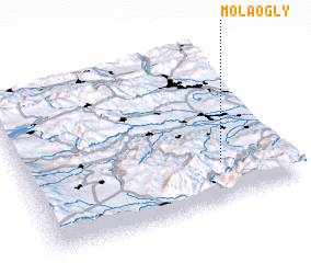 Places with similar names to Molaogly, Georgia ::
// Mawlaikkale (MM)
// Mèlako-alè (MM)
// Mǝlikli (AZ)
// Mǝlikli (AZ)
// Melikli (AZ)
// Melikli (AZ)
// Mülkülü (AZ)
// Milkel (DE)
// Mäliküla (EE)
// Mala Kula (BA)
Disclaimer :: Information on this page comes without warranty of any kind |
||
|
Where is Molaogly? Elevation and coordinates ::
Latitude (lat): 41°14'0"N Longitude (lon): 44°45'0"E
Elevation (approx.): 569m (map arrows pan, magnifying glasses zoom) |
||
|
Visiting Molaogly? Hotel/Accommodation ::
Book a hotel in Molaogly Travel Guide ::
Buy a travel guide for Georgia rental cars ::
car rental offers GPS waypoint ::
download a GPX waypoint (PoI) of Molaogly for your GPS receiver
|
||