|
search place name
|
||
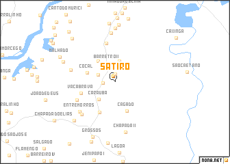
Sátiro (Piauí, Brazil)Sátiro is a town in the Piauí region of Brazil. An overview map of the region around Sátiro is displayed below.
regional and 3d topo map of Sátiro, Brazil ::
Sátiro airports ::
The nearest airport is THE - Teresina Senador Petronio Portella, located 200.8 km south west of Sátiro.
Nearby towns ::
Pau-dʼArco (1.3km north) //
Sítio (1.9km west) //
Pitombeira (3.0km north west) //
Barretro II (3.3km north west) //
São Félix (3.5km north) //
Caraúba (3.9km south west) //
Baixão I (4.3km north west) //
Cocal (4.7km west) //
Cágado (5.2km south east) //
Baixa do Jacaré (5.6km south west) //
Vaca Brava (5.8km west) //
Belo Hurizonte (6.5km north) //
Baixão das Cajazeiras (6.9km south west) //
Chapada I (7.5km west) //
Entre Morros (7.5km south west) //
Lagoa de Dentro I (7.6km south west) //
Boa Vista (8.0km north) //
Chapada II (8.4km south) //
Porcos (8.7km north) //
Morcegão (9.1km west) //
Sudene (9.1km south west) //
Barro Vermelho (9.9km north west) //
Sabonete (11.1km north west) //
[all distances 'as the bird flies' and approximate]  Places with similar names to Sátiro, Brazil ::
Disclaimer :: Information on this page comes without warranty of any kind |
||
|
Where is Sátiro? Elevation and coordinates ::
Latitude (lat): 3°25'52"S Longitude (lon): 42°1'23"W
Elevation (approx.): 38m (map arrows pan, magnifying glasses zoom) |
||
|
Visiting Sátiro? Hotel/Accommodation ::
Book a hotel in Sátiro Travel Guide ::
Buy a travel guide for Brazil rental cars ::
car rental offers GPS waypoint ::
download a GPX waypoint (PoI) of Sátiro for your GPS receiver
|
||