|
search place name
|
||
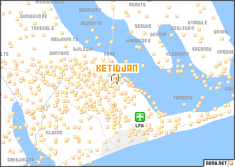
Kétidjan (Préfecture de Lomé, Togo)Kétidjan is a town in the Préfecture de Lomé region of Togo. An overview map of the region around Kétidjan is displayed below.
regional and 3d topo map of Kétidjan, Togo ::
Kétidjan airports ::
The nearest airport is LFW - Lome Gnassingbe Eyadema Intl, located 6.4 km south east of Kétidjan.
Other airports nearby include COO - Cotonou Cadjehoun (129.6 km east), ACC - Accra Kotoka Intl (167.9 km south west), Nearby towns ::
Agbénouvon (0.6km south) //
Dodji (0.7km east) //
Agbézourhlan (0.7km north east) //
Vyévépé (0.7km north west) //
Tokpo (0.8km south) //
Akoé (0.9km west) //
Kodjo (0.9km south west) //
Adablai (0.9km south) //
Ala (1.2km west) //
Adjougba (1.3km north) //
Adjavon (1.3km north) //
Avéimé (1.4km north east) //
Agokpwi (1.5km north) //
Togomé (1.6km north) //
Agoué (1.7km south) //
Alikopé (1.7km east) //
Azogénou (1.8km south) //
Atiso (1.8km south east) //
Kopégan (1.8km east) //
Nélimé (1.8km east) //
Bla (1.9km west) //
Masorthé (1.9km south west) //
Hebé (2.0km south east) //
Atchavé (2.0km north west) //
Kélégouvi (2.1km south) //
Amou (2.1km west) //
Séméba (2.2km east) //
Aogan (2.2km south west) //
Kpatéfi (2.2km west) //
[all distances 'as the bird flies' and approximate]  Places with similar names to Kétidjan, Togo ::
// Kouetdjina (CM)
Disclaimer :: Information on this page comes without warranty of any kind |
||
|
Where is Kétidjan? Elevation and coordinates ::
Latitude (lat): 6°12'50"N Longitude (lon): 1°13'20"E
Elevation (approx.): 31m (map arrows pan, magnifying glasses zoom) |
||
|
Visiting Kétidjan? Hotel/Accommodation ::
Book a hotel in Kétidjan Travel Guide ::
Buy a travel guide for Togo rental cars ::
car rental offers GPS waypoint ::
download a GPX waypoint (PoI) of Kétidjan for your GPS receiver
|
||