|
search place name
|
||
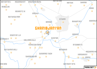
Gharibjanyan ((( Amasiayi Shrjan )), Armenia)Gharibjanyan is a town in the (( Amasiayi Shrjan )) region of Armenia. An overview map of the region around Gharibjanyan is displayed below.
regional and 3d topo map of Gharibjanyan, Armenia ::
Nearby towns ::
Akhurik (1.2km west) //
Getk (1.8km south west) //
Voskehask (2.0km south west) //
Haykavan (2.5km north west) //
Azatan (3.2km south east) //
Arrapʼi (3.7km north) //
Bayandur (5.4km south) //
Yerazgavors (5.7km south west) //
Yerazgavors (6.5km south west) //
Gyumri (6.4km north east) //
Kalkankale (6.3km south west) //
Voghji (8.0km north west) //
Gusanagyugh (8.6km south) //
Çetindurak (7.4km south west) //
Beniamin (8.3km south east) //
Noraber (9.2km south) //
Saratak (10.3km south east) //
Lusakert (10.6km south east) //
[all distances 'as the bird flies' and approximate]  Places with similar names to Gharibjanyan, Armenia :: Disclaimer :: Information on this page comes without warranty of any kind |
||
|
Where is Gharibjanyan? Elevation and coordinates ::
Latitude (lat): 40°44'46"N Longitude (lon): 43°47'49"E
Elevation (approx.): 1466m (map arrows pan, magnifying glasses zoom) |
||
|
Visiting Gharibjanyan? Hotel/Accommodation ::
Book a hotel in Gharibjanyan Travel Guide ::
Buy a travel guide for Armenia rental cars ::
car rental offers GPS waypoint ::
download a GPX waypoint (PoI) of Gharibjanyan for your GPS receiver
|
||