|
search place name
|
||
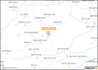
Ağdǝrǝ (Tǝrtǝr, Azerbaijan)Ağdǝrǝ is a town in the Tǝrtǝr region of Azerbaijan. An overview map of the region around Ağdǝrǝ is displayed below.
regional and 3d topo map of Ağdǝrǝ, Azerbaijan ::
Nearby towns ::
Ağabǝyyalı (2.1km west) //
Aşağı Oratağ (3.8km south west) //
Jraberd (4.7km north east) //
Godaksar (6.2km north west) //
Kiçik Qarabǝy (5.1km west) //
Shorbulag (7.0km north) //
Papravǝnd (6.8km south) //
Qarapirimli (7.7km south east) //
Gülyataq (7.7km south west) //
Damirlou (7.1km south west) //
Dǝmirli (7.1km south west) //
Boyǝhmǝdli (9.4km south) //
Çanyataq (9.3km south west) //
Mollalar (9.2km south east) //
Sofulu (9.9km south east) //
[all distances 'as the bird flies' and approximate]  Places with similar names to Ağdǝrǝ, Azerbaijan ::
Disclaimer :: Information on this page comes without warranty of any kind |
||
|
Where is Ağdǝrǝ? Elevation and coordinates ::
Latitude (lat): 40°12'55"N Longitude (lon): 46°48'46"E
Elevation (approx.): 467m (map arrows pan, magnifying glasses zoom) |
||
|
Visiting Ağdǝrǝ? Hotel/Accommodation ::
Book a hotel in Ağdǝrǝ Travel Guide ::
Buy a travel guide for Azerbaijan rental cars ::
car rental offers GPS waypoint ::
download a GPX waypoint (PoI) of Ağdǝrǝ for your GPS receiver
|
||