|
search place name
|
||
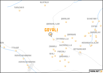
Göyǝli (Gǝdǝbǝy, Azerbaijan)Göyǝli is a town in the Gǝdǝbǝy region of Azerbaijan. An overview map of the region around Göyǝli is displayed below.
regional and 3d topo map of Göyǝli, Azerbaijan ::
Nearby towns ::
Şınıx (1.3km south east) //
Hacılar (2.4km north east) //
Qaravǝlilǝr (3.5km north) //
Çay Rǝsullu (3.7km south east) //
Zamanlı (4.8km south) //
Kilsǝli (3.8km east) //
Arabaçı (5.4km south) //
Düz Rǝsullu (5.8km south east) //
Qasımağalı (7.2km south) //
İsalı (7.4km south) //
Qaralar (6.7km north east) //
Qaradaş (5.7km east) //
Fǝrzalı (7.2km south east) //
Göyǝbaxan (6.8km east) //
Qasımağlı (9.3km south east) //
[all distances 'as the bird flies' and approximate]  Places with similar names to Göyǝli, Azerbaijan ::
Disclaimer :: Information on this page comes without warranty of any kind |
||
|
Where is Göyǝli? Elevation and coordinates ::
Latitude (lat): 40°41'51"N Longitude (lon): 45°25'19"E
Elevation (approx.): 1641m (map arrows pan, magnifying glasses zoom) |
||
|
Visiting Göyǝli? Hotel/Accommodation ::
Book a hotel in Göyǝli Travel Guide ::
Buy a travel guide for Azerbaijan rental cars ::
car rental offers GPS waypoint ::
download a GPX waypoint (PoI) of Göyǝli for your GPS receiver
|
||