|
search place name
|
||
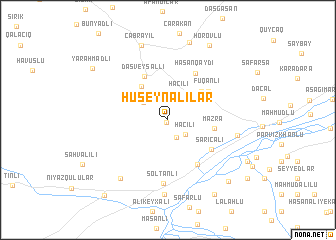
Hüseynalılar (Cǝbrayıl, Azerbaijan)Hüseynalılar is a town in the Cǝbrayıl region of Azerbaijan. An overview map of the region around Hüseynalılar is displayed below.
regional and 3d topo map of Hüseynalılar, Azerbaijan ::
Hüseynalılar airports ::
The nearest airport is TBZ - Tabriz Intl, located 150.1 km south west of Hüseynalılar.
Nearby towns ::
Miryak (0.3km south) //
Kavdar (2.1km south) //
Hacılı (2.2km south east) //
Hacılı (3.1km north) //
Minbaşılı (2.9km north west) //
Ağtǝpǝ (4.4km north west) //
Imambagi (4.3km north east) //
Mazra (4.1km east) //
Daş Veysǝlli (5.2km north west) //
Fuqanlı (4.8km north east) //
Sarıcalı (5.0km south east) //
Əmirvarlı (5.6km south east) //
Hǝsǝnqaydı (5.7km north east) //
Soltanlı (7.1km south) //
Shykhaliagaly (6.2km east) //
Kovshutlu (8.3km south) //
Kechalmamedli (7.7km south west) //
Cǝbrayil (8.7km north) //
Papı (8.8km north) //
Horovlu (9.1km north east) //
Kadkhodālū-ye ‘Olyā (8.6km south east) //
Sārī Yātāq (9.3km south east) //
Yarǝhmǝdli (8.7km north west) //
Göyǝrçin Veysǝlli (10.0km south west) //
[all distances 'as the bird flies' and approximate]  Places with similar names to Hüseynalılar, Azerbaijan ::
// Hasanaliler (TR)
Disclaimer :: Information on this page comes without warranty of any kind |
||
|
Where is Hüseynalılar? Elevation and coordinates ::
Latitude (lat): 39°19'30"N Longitude (lon): 47°3'11"E
Elevation (approx.): 329m (map arrows pan, magnifying glasses zoom) |
||
|
Visiting Hüseynalılar? Hotel/Accommodation ::
Book a hotel in Hüseynalılar Travel Guide ::
Buy a travel guide for Azerbaijan rental cars ::
car rental offers GPS waypoint ::
download a GPX waypoint (PoI) of Hüseynalılar for your GPS receiver
|
||