|
search place name
|
||
Karagëz (Zǝngilan, Azerbaijan)Karagëz is a town in the Zǝngilan region of Azerbaijan. An overview map of the region around Karagëz is displayed below.
regional and 3d topo map of Karagëz, Azerbaijan ::

Karagëz airports ::
The nearest airport is TBZ - Tabriz Intl, located 105.2 km south of Karagëz.
Nearby towns ::
Qaradǝrǝ (0.7km north east) //
Ördǝkli (2.0km north west) //
Çöpǝdǝrǝ (2.2km south west) //
Baharlı (2.1km east) //
Tarakema (2.7km east) //
Dǝllǝkli (3.8km south) //
Būʼīdūz (4.0km east) //
Qıraq Muşlan (5.1km north east) //
Udgyun (4.8km north east) //
Şǝfibǝyli (5.6km north west) //
Ūzān (6.4km south) //
İçǝri (6.6km north) //
Kargulu (6.5km south) //
Melikli (6.2km north east) //
Zǝngilan (6.0km north east) //
Mīnā Dāghī (6.0km south east) //
Mincivan (5.7km east) //
Sobu (5.7km west) //
Turabad (6.1km east) //
İçǝri Muşlan (6.9km north east) //
Mǝşǝdismayıllı (6.9km north west) //
Ebrāhīm Samī‘ (8.2km south) //
Malatkeşin (8.5km north) //
Bartaz (7.4km south west) //
Qareh Qūch (7.1km east) //
Beshdali (9.3km north west) //
Mashhadī Ḩasanlū (9.8km south east) //
[all distances 'as the bird flies' and approximate] 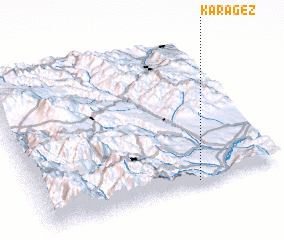 Places with similar names to Karagëz, Azerbaijan ::
Disclaimer :: Information on this page comes without warranty of any kind |
||
|
Where is Karagëz? Elevation and coordinates ::
Latitude (lat): 39°1'23"N Longitude (lon): 46°39'13"E
Elevation (approx.): 381m (map arrows pan, magnifying glasses zoom) |
||
|
Visiting Karagëz? Hotel/Accommodation ::
Book a hotel in Karagëz Travel Guide ::
Buy a travel guide for Azerbaijan rental cars ::
car rental offers GPS waypoint ::
download a GPX waypoint (PoI) of Karagëz for your GPS receiver
|
||