|
search place name
|
||
Kilsǝli (Kǝlbǝcǝr, Azerbaijan)Kilsǝli is a town in the Kǝlbǝcǝr region of Azerbaijan. An overview map of the region around Kilsǝli is displayed below.
regional and 3d topo map of Kilsǝli, Azerbaijan ::

Kilsǝli airports ::
The nearest airport is TBZ - Tabriz Intl, located 220.4 km south of Kilsǝli.
Nearby towns ::
Gyuzeychirkin (3.2km north west) //
Kushyuvasy (3.1km south east) //
Byazirkhana (3.9km north) //
Comǝrd (3.5km north east) //
Nadzhafalylar (3.7km north east) //
Karadzhanly (5.8km south) //
Zülfüqarlı (5.8km south east) //
Almalıq (5.3km south east) //
Abdullauşağı (7.0km south) //
Laçın (5.6km east) //
Mozkǝnd (6.4km south west) //
Qılıçlı (6.7km north west) //
Başkǝnd (5.8km west) //
Nadirxanlı (7.6km north) //
Sarıdaş (9.7km north west) //
Alchaly (9.4km north west) //
[all distances 'as the bird flies' and approximate] 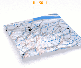 Places with similar names to Kilsǝli, Azerbaijan ::
// Kilsǝli (AZ)
// Gläsel (DE)
// Calzaiolo (IT)
// Collescille (IT)
// Collicelli (IT)
// Collicello (IT)
// Collicello (IT)
// Çalışlı (TR)
// Kalaycılı (TR)
// Kylys-Allyy (RU)
Disclaimer :: Information on this page comes without warranty of any kind |
||
|
Where is Kilsǝli? Elevation and coordinates ::
Latitude (lat): 40°7'8"N Longitude (lon): 46°11'21"E
Elevation (approx.): 1736m (map arrows pan, magnifying glasses zoom) |
||
|
Visiting Kilsǝli? Hotel/Accommodation ::
Book a hotel in Kilsǝli Travel Guide ::
Buy a travel guide for Azerbaijan rental cars ::
car rental offers GPS waypoint ::
download a GPX waypoint (PoI) of Kilsǝli for your GPS receiver
|
||