|
search place name
|
||
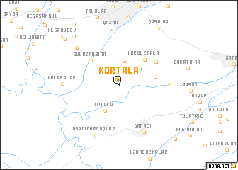
Kortala (Balakǝn, Azerbaijan)Kortala is a town in the Balakǝn region of Azerbaijan. An overview map of the region around Kortala is displayed below.
regional and 3d topo map of Kortala, Azerbaijan ::
Kortala airports ::
The nearest airport is MCX - Makhachkala Uytash, located 169.9 km north east of Kortala.
Nearby towns ::
Biçiqarbinǝ (2.4km north west) //
Roçǝhmǝd (3.8km north) //
Püştǝtala (3.5km north east) //
İtitala (4.4km south) //
Murquztala (5.0km north east) //
Əyritala (5.0km north east) //
Qamıştala (4.4km east) //
Gülüzǝnbinǝ (5.1km north west) //
Qadaşbina (5.7km north east) //
Uzuntala (5.9km east) //
Danaçı (7.8km south) //
Aşağı Çardaqlar (8.4km south) //
Qazma (8.8km north) //
Şambulbinǝ (7.7km north west) //
Ağkilsǝ (9.3km north west) //
Qasbinǝ (10.1km north east) //
Şarıbulaq (9.7km north west) //
Xalatalabinǝ (10.7km south east) //
[all distances 'as the bird flies' and approximate]  Places with similar names to Kortala, Azerbaijan ::
Disclaimer :: Information on this page comes without warranty of any kind |
||
|
Where is Kortala? Elevation and coordinates ::
Latitude (lat): 41°36'52"N Longitude (lon): 46°22'49"E
Elevation (approx.): 211m (map arrows pan, magnifying glasses zoom) |
||
|
Visiting Kortala? Hotel/Accommodation ::
Book a hotel in Kortala Travel Guide ::
Buy a travel guide for Azerbaijan rental cars ::
car rental offers GPS waypoint ::
download a GPX waypoint (PoI) of Kortala for your GPS receiver
|
||