|
search place name
|
||
Malıbǝy (Laçın, Azerbaijan)Malıbǝy is a town in the Laçın region of Azerbaijan. An overview map of the region around Malıbǝy is displayed below.
regional and 3d topo map of Malıbǝy, Azerbaijan ::

Malıbǝy airports ::
The nearest airport is TBZ - Tabriz Intl, located 165.9 km south of Malıbǝy.
Nearby towns ::
Sultan (2.4km north east) //
Qışlaq (3.3km north) //
Hüsülü (3.2km north west) //
Ziyrik (3.8km north) //
Cağazur (4.0km south east) //
Uludyuz (3.9km north east) //
Zeyvǝ (4.9km north) //
Khnatsakh (4.1km south west) //
Novruzlu (4.4km south east) //
Hoçaz (6.4km north) //
Aravus (6.9km south east) //
Hacılar (6.1km north west) //
Qarıqışlaq (6.7km north west) //
Vaghatur (6.1km west) //
Qızılca (6.3km east) //
Mollalar (7.0km north east) //
Tegh (8.1km south east) //
Sus (6.7km east) //
Mais (8.6km north) //
Khoznavar (6.8km west) //
Sonasar (8.9km north) //
Karykakha (7.3km north east) //
Soyukbulak (9.0km north west) //
Qılıçlı (9.8km north west) //
[all distances 'as the bird flies' and approximate] 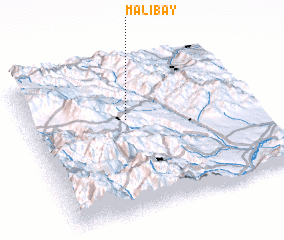 Places with similar names to Malıbǝy, Azerbaijan ::
Disclaimer :: Information on this page comes without warranty of any kind |
||
|
Where is Malıbǝy? Elevation and coordinates ::
Latitude (lat): 39°37'13"N Longitude (lon): 46°26'8"E
Elevation (approx.): 1140m (map arrows pan, magnifying glasses zoom) |
||
|
Visiting Malıbǝy? Hotel/Accommodation ::
Book a hotel in Malıbǝy Travel Guide ::
Buy a travel guide for Azerbaijan rental cars ::
car rental offers GPS waypoint ::
download a GPX waypoint (PoI) of Malıbǝy for your GPS receiver
|
||