|
search place name
|
||
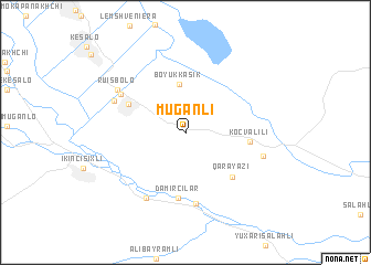
Muğanlı (Ağstafa, Azerbaijan)Muğanlı is a town in the Ağstafa region of Azerbaijan. An overview map of the region around Muğanlı is displayed below.
regional and 3d topo map of Muğanlı, Azerbaijan ::
Nearby towns ::
Böyük Kǝsik (4.9km north) //
Sadıqlı (5.2km north west) //
Qarayazı (5.7km south east) //
Köçvǝlili (4.9km east) //
Dǝmirçilǝr (6.6km south) //
Ömǝrağalı (7.2km south) //
Sadykhly (6.3km north west) //
Birinci Şıxlı (7.3km south west) //
Akhali Ulianovka (6.3km north west) //
Ruisbolo (6.7km north west) //
Soyuqbulaq (6.3km east) //
[all distances 'as the bird flies' and approximate]  Places with similar names to Muğanlı, Azerbaijan ::
Disclaimer :: Information on this page comes without warranty of any kind |
||
|
Where is Muğanlı? Elevation and coordinates ::
Latitude (lat): 41°20'39"N Longitude (lon): 45°11'42"E
Elevation (approx.): 258m (map arrows pan, magnifying glasses zoom) |
||
|
Visiting Muğanlı? Hotel/Accommodation ::
Book a hotel in Muğanlı Travel Guide ::
Buy a travel guide for Azerbaijan rental cars ::
car rental offers GPS waypoint ::
download a GPX waypoint (PoI) of Muğanlı for your GPS receiver
|
||