|
search place name
|
||
Muğanlı (Zǝngilan, Azerbaijan)Muğanlı is a town in the Zǝngilan region of Azerbaijan. An overview map of the region around Muğanlı is displayed below.
regional and 3d topo map of Muğanlı, Azerbaijan ::

Muğanlı airports ::
The nearest airport is TBZ - Tabriz Intl, located 116.3 km south west of Muğanlı.
Nearby towns ::
Khurama (1.1km south) //
Genanly (2.1km north east) //
Hacıalılı (3.6km north east) //
Tow 'Ali-ye 'Olyā (4.4km south) //
Kūrzeh (4.1km south east) //
Şarifan (5.0km north) //
Tātār-e Pāʼīn (5.0km south east) //
Xumarlı (5.7km north) //
Tātār-e Bālā (6.0km south) //
Dzhakhangirbeyli (5.5km south west) //
Ţow 'Ali-ye Soflá (5.4km south east) //
Saryl (6.7km north) //
Tiri (6.6km south) //
Alybeyli Vtoryye (7.4km north) //
Mǝmmǝdbǝyli (7.8km north) //
Babayly (8.3km north) //
Turabad (7.4km south west) //
Havalı (8.0km north east) //
İçǝri Muşlan (7.0km west) //
Darīlū (6.9km east) //
Qareh Qūch-e Mīn Bāshī (8.6km south) //
Alıbǝyli (8.5km north) //
Mincivan (8.5km south west) //
Vīnaq (10.2km south east) //
Tatar (10.2km north west) //
[all distances 'as the bird flies' and approximate] 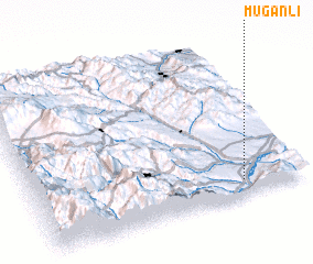 Places with similar names to Muğanlı, Azerbaijan ::
Disclaimer :: Information on this page comes without warranty of any kind |
||
|
Where is Muğanlı? Elevation and coordinates ::
Latitude (lat): 39°5'29"N Longitude (lon): 46°46'40"E
Elevation (approx.): 304m (map arrows pan, magnifying glasses zoom) |
||
|
Visiting Muğanlı? Hotel/Accommodation ::
Book a hotel in Muğanlı Travel Guide ::
Buy a travel guide for Azerbaijan rental cars ::
car rental offers GPS waypoint ::
download a GPX waypoint (PoI) of Muğanlı for your GPS receiver
|
||