|
search place name
|
||
Pirǝyir (Ağdaş, Azerbaijan)Pirǝyir is a town in the Ağdaş region of Azerbaijan. An overview map of the region around Pirǝyir is displayed below.
regional and 3d topo map of Pirǝyir, Azerbaijan ::

Nearby towns ::
Gürcuva (1.7km east) //
Qaradağlı (2.3km north west) //
Cucuk (2.2km west) //
Nehrǝxǝlil (3.9km south) //
Ağdaş (4.2km north) //
Kotanarx (3.7km south east) //
Beşdǝli (3.7km south east) //
Tatlar (4.6km north) //
Aşağı Zeynǝddin (4.6km north west) //
Mǝsǝd (4.7km north east) //
İkinci Şordǝhnǝ (4.2km east) //
Ağalı (5.6km north) //
Aşağı Qolqǝti (6.3km north) //
Aşağı Qǝsil (4.8km east) //
Davudlu (5.2km south west) //
Orta Qǝsil (5.3km north east) //
Lǝki (6.6km south west) //
Cardam (6.4km south east) //
Dǝhnǝxǝlil (7.3km north) //
Yuxarı Qǝsil (6.5km north east) //
Yeniarx (6.7km north west) //
Korarx (7.7km north) //
Yenicǝ (8.0km south) //
Birinci Şordǝhnǝ (6.3km east) //
Binǝlǝr (6.9km south west) //
Qaraqan Sǝdi (6.6km east) //
Mürsǝl (7.0km west) //
Bulaqotağı (7.4km north east) //
Sıxlı (7.8km north west) //
[all distances 'as the bird flies' and approximate] 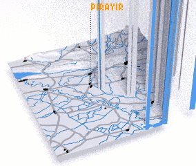 Places with similar names to Pirǝyir, Azerbaijan ::
Disclaimer :: Information on this page comes without warranty of any kind |
||
|
Where is Pirǝyir? Elevation and coordinates ::
Latitude (lat): 40°36'51"N Longitude (lon): 47°27'35"E
Elevation (approx.): 27m (map arrows pan, magnifying glasses zoom) |
||
|
Visiting Pirǝyir? Hotel/Accommodation ::
Book a hotel in Pirǝyir Travel Guide ::
Buy a travel guide for Azerbaijan rental cars ::
car rental offers GPS waypoint ::
download a GPX waypoint (PoI) of Pirǝyir for your GPS receiver
|
||