|
search place name
|
||
Port-İliç (Lǝnkǝran, Azerbaijan)Port-İliç is a town in the Lǝnkǝran region of Azerbaijan. An overview map of the region around Port-İliç is displayed below.
regional and 3d topo map of Port-İliç, Azerbaijan ::

Port-İliç airports ::
The nearest airport is RAS - Rasht, located 185.3 km south of Port-İliç.
Other airports nearby include BAK - Baku Heydar Aliyev (206.2 km north east), RZR - Ramsar (272.8 km south east), Nearby towns ::
Nǝrimanabad (2.8km east) //
Boladı (4.5km north west) //
Kazımlı Cil (5.5km south west) //
Göyşaban (7.1km south) //
Molalan (6.3km north west) //
Qumbaşı (7.6km north) //
Şağlasǝr (6.3km west) //
Marushli (8.3km south) //
Girdǝni (8.7km south) //
Viravul (8.2km south west) //
Vilvan (8.1km south west) //
[all distances 'as the bird flies' and approximate] 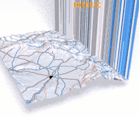 Places with similar names to Port-İliç, Azerbaijan ::
// Portlock (US)
// Prętławki (PL)
// Portelek (HU)
// Pertylga (RU)
// Pruitt Lake (US)
// Portlock (US)
// Puerto Leguía (PE)
// Port à lʼÉcu (HT)
// Přítluky (CZ)
// Peredelka (BY)
Disclaimer :: Information on this page comes without warranty of any kind |
||
|
Where is Port-İliç? Elevation and coordinates ::
Latitude (lat): 38°52'24"N Longitude (lon): 48°48'50"E
Elevation (approx.): -25m (map arrows pan, magnifying glasses zoom) |
||
|
Visiting Port-İliç? Hotel/Accommodation ::
Book a hotel in Port-İliç Travel Guide ::
Buy a travel guide for Azerbaijan rental cars ::
car rental offers GPS waypoint ::
download a GPX waypoint (PoI) of Port-İliç for your GPS receiver
|
||