|
search place name
|
||
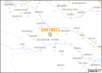
Shotaryz (Zǝngilan, Azerbaijan)Shotaryz is a town in the Zǝngilan region of Azerbaijan. An overview map of the region around Shotaryz is displayed below.
regional and 3d topo map of Shotaryz, Azerbaijan ::
Shotaryz airports ::
The nearest airport is TBZ - Tabriz Intl, located 109.4 km south of Shotaryz.
Nearby towns ::
Keçikli (2.1km north east) //
Dyuman (2.7km south east) //
Rǝzdǝrǝ (3.0km south east) //
Kollugıslaq (3.2km south west) //
Qaragöl (4.1km north) //
Yusiflar (4.5km north west) //
Top (5.1km south) //
Nǝcǝflǝr (4.5km north west) //
Mǝşǝdismayıllı (4.6km south east) //
Beshdali (4.5km east) //
Şayıflı (5.9km north west) //
Nerkʼin Hand (5.9km south west) //
Srashen (5.1km west) //
Şǝfibǝyli (6.2km south east) //
Sobu (7.2km south east) //
Geyali (7.3km north west) //
Shikahogh (6.7km west) //
Burunlu (8.6km north west) //
Dzhafarkuluushagy (9.0km north east) //
Aladin (9.0km north east) //
Canbar (10.0km north west) //
Böyük Gilǝtağ (10.5km north east) //
[all distances 'as the bird flies' and approximate]  Places with similar names to Shotaryz, Azerbaijan ::
// Shtrazë (AL)
// Shtrez (AL)
// Shtrezë (AL)
// Chetriş (RO)
// Chetrosu (RO)
// Chetrosu (RO)
// Chāh Darāz (IR)
// Chah Derāz (IR)
// Chāh Derāz (IR)
// Chāy Darsī (IR)
Disclaimer :: Information on this page comes without warranty of any kind |
||
|
Where is Shotaryz? Elevation and coordinates ::
Latitude (lat): 39°5'15"N Longitude (lon): 46°33'4"E
Elevation (approx.): 807m (map arrows pan, magnifying glasses zoom) |
||
|
Visiting Shotaryz? Hotel/Accommodation ::
Book a hotel in Shotaryz Travel Guide ::
Buy a travel guide for Azerbaijan rental cars ::
car rental offers GPS waypoint ::
download a GPX waypoint (PoI) of Shotaryz for your GPS receiver
|
||