|
search place name
|
||
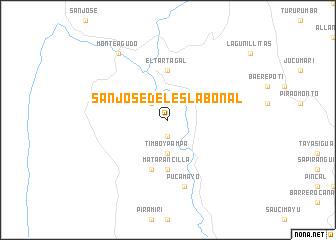
San José del Eslabonal (Chuquisaca, Bolivia)San José del Eslabonal is a town in the Chuquisaca region of Bolivia. An overview map of the region around San José del Eslabonal is displayed below.
regional and 3d topo map of San José del Eslabonal, Bolivia ::
San José del Eslabonal airports ::
The nearest airport is SRE - Sucre Juana Azurduy De Padilla, located 172.2 km north west of San José del Eslabonal.
Other airports nearby include POI - Potosi Capitan Nicolas Rojas (191.4 km west), TJA - Tarija Capitan Oriel Lea Plaza (201.7 km south west), Nearby towns ::
Peñaderia (1.9km south) //
Suspiros (2.5km north west) //
Timboypampa (3.7km south) //
Matarancilla (5.6km south) //
El Tartagal (5.6km north) //
Timboy (5.8km south) //
Pucamayo (7.6km south) //
Monteagudo (9.1km north west) //
[all distances 'as the bird flies' and approximate]  Places with similar names to San José del Eslabonal, Bolivia :: Disclaimer :: Information on this page comes without warranty of any kind |
||
|
Where is San José del Eslabonal? Elevation and coordinates ::
Latitude (lat): 19°53'0"S Longitude (lon): 63°56'0"W
Elevation (approx.): 1183m (map arrows pan, magnifying glasses zoom) |
||
|
Visiting San José del Eslabonal? Hotel/Accommodation ::
Book a hotel in San José del Eslabonal Travel Guide ::
Buy a travel guide for Bolivia rental cars ::
car rental offers GPS waypoint ::
download a GPX waypoint (PoI) of San José del Eslabonal for your GPS receiver
|
||